Catanduanes Island
| Catanduanes | |||
|---|---|---|---|
| Province | |||
| Province of Catanduanes | |||
|
|||
| Nickname(s): The Happy Island, Land of the Howling Winds | |||
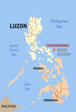
 Location in the Philippines |
|||
| Coordinates: 13°50′N 124°15′E / 13.83°N 124.25°ECoordinates: 13°50′N 124°15′E / 13.83°N 124.25°E | |||
| Country | Philippines | ||
| Region | Bicol Region (Region V) | ||
| Founded | September 26, 1945 | ||
| Capital | Virac | ||
| Government | |||
| • Type | Sangguniang Panlalawigan | ||
| • Governor | Joseph C. Cua (United Nationalist Alliance (UNA)) | ||
| • Vice Governor | Shirley Abundo (Nationalist People's Coalition (NPC)) | ||
| Area | |||
| • Total | 1,492.16 km2 (576.13 sq mi) | ||
| Area rank | 70th out of 81 | ||
| Highest elevation (Mount Cagmasoso) | 803 m (2,635 ft) | ||
| Population (2015 census) | |||
| • Total | 260,964 | ||
| • Rank | 67th out of 81 | ||
| • Density | 170/km2 (450/sq mi) | ||
| • Density rank | 50th out of 81 | ||
| Divisions | |||
| • Independent cities | 0 | ||
| • Component cities | 0 | ||
| • Municipalities | |||
| • Barangays | 315 | ||
| • Districts | Lone district of Catanduanes | ||
| Time zone | PST (UTC+8) | ||
| ZIP codes | 4800–4810 | ||
| IDD : area code | +63 (0)52 | ||
| ISO 3166 code | PH | ||
| Spoken languages | |||
| Demonym | Catandunganon | ||
| Website | catanduanes |
||
Catanduanes is an island province located in the Bicol Region of Luzon in the Philippines. It is the 12th-largest Island in the Philippines. Its capital is Virac and the province lies to the east of Camarines Sur across Maqueda Channel. It had a population of 260,964 people as registered in the 2015 census.
The province comprises Catanduanes Island (also called Virac Island), the Panay Island, Lete Island, Palumbanes group of islands (Porongpong, Tignob and Calabagio) and a few other minor surrounding islets and rocks.
Catanduanes was a former sub-province of Ambos Camarines in the early 1900s and later of Albay. It gained provincial autonomy when Congressman Francisco Perfecto filled House Bill No. 301 which separated the province from Albay. It was approved on September 26, 1945 and subsequently signed into law by President Sergio Osmeña on October 24, 1945. Remigio Socito, the last Lieutenant Governor, was appointed as the first Provincial Governor. When elections were held in 1947, Alfonso V. Usero became the first elected Governor.
Isla de Cobos was Catanduanes' first name, given by Spanish conquistadores during the early part of 1573 when came upon several tribes living in the thatched huts called cobos.
Catanduanes, is a hispanized term derived from the word tandu, a native beetle and the samdong tree, which were both found in abundance throughout the island. Common reference to katanduan or kasamdongan, meaning a place where the tandu or the samdong tree thrives in abundance, led to the coining of the word Catanduanes.
Bornean datus settled on the island of Panay. Their descendants then migrated throughout the archipelago and became the first settlers in Catanduanes. The island was not spared from raids of the Moros coming from the island of Mindanao. Because of these destructive raids, many records of the past were destroyed and lost.
...
Wikipedia


