Carrignamuck Tower House
| Alternate name | Dripsey Castle |
|---|---|
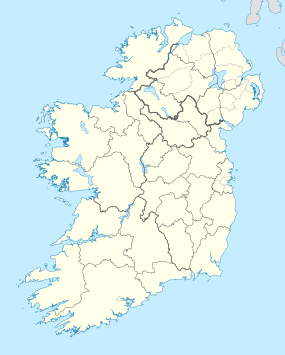
| Location | Carrignamuck, County Cork, Ireland |
| Coordinates | 51°55′41″N 8°45′17″W / 51.92806°N 8.75472°WCoordinates: 51°55′41″N 8°45′17″W / 51.92806°N 8.75472°W |
| Type | Tower house |
| History | |
| Builder | Cormac Láidir MacCarthy |
| Founded | late 15th century |
| Site notes | |
| Condition | Ruined |
| Ownership | Private |
| Public access | No |
Carrignamuck Tower House, located in Carrignamuck townland, is situated 2.8 km (1.7 mi) north of Coachford village and 2 km (1.2 mi) north-west of Dripsey village. It is also known as 'Dripsey Castle,' a name more properly attributed to nearby Dripsey Castle, Carrignamuck.
The structure is a tower house, as opposed to a castle, and was one of a chain of MacCarthy of Muskerry tower houses extending westwards beyond Macroom. Tower houses were built during the fifteenth and sixteenth centuries as residences by Gaelic and Old English families, and though not castles in the strict sense, retained many similar features such as battlements, machicolations and narrow slit windows. Carrignamuck is an L-shaped, five-storey tower, which was repaired in 1866 when a slate roof, fireplaces, and wooden front door were inserted. The entrance is set into the east wall, and the ground floor contains a lobby, main chamber, fireplace, smaller chamber and concrete floor. The first floor contains main, secondary, garderobe and murder-hole chambers, with one of its windows containing a timber frame said to come from the former Church of Ireland parish church at Aghabullogue. The second floor has a main chamber with fireplace, and a garderobe chamber. The third floor contains a main chamber and a smaller chamber. The fourth floor contains a main chamber with fireplace and slate roof, the remains of a smaller chamber, and access to an external wall-walk with no surviving battlements. Adjoining the tower house are terraces, which may be the result of earlier demesne landscaping.
The tower house is firstly depicted on a sketch map the description of Muskery of c. 1590 and named 'Carrigomuck'. It is also depicted on the Down Survey Map of 1656-8, with the accompanying terrier stating that 'on Carrignemucke stands a castle and a mill'.
Smith (1774) describes the 'Castle of Carrignamuck' as inhabited by Mr. Bear, once belonging to the Mac-Carthys, situated on the Muskerry side of the (Dripsey) river, and having a garrison of Oliver Cromwell stationed there for some time. Lewis (1837) mentions the 'ancient castle of Carrignamuck' as built in the fifteenth century by the founder of Blarney Castle, and being situated on the bank of the Dripsey River, surrounded by trees, within the parish of Magourney. The tower house is described in the Ordnance Survey name book (c. 1840) and depicted in both the OS 1842 and 1901 surveyed maps as a ruin. Gillman (1892) advises that it was known as Carrig na Muc castle, and according to tradition was built by Cormac Laidir MacCarthy, lord of Muskerry 1455-1495.
...
Wikipedia

