Carrawburgh
| Carrawburgh | |
|---|---|

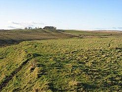
Southern rampart of Brocolitia
|
|
| Alternative name(s) | Brocolitia, Procolita, or Brocolita |
| Province | Britannia |
| — Cohorts — | |
| Coordinates | 55°02′10″N 2°13′23″W / 55.036°N 2.223°W |
| County | Northumberland |
| Country | England |
| UK-OSNG reference | NY858712 |
Coordinates: 55°02′10″N 2°13′23″W / 55.036°N 2.223°W
Carrawburgh is a settlement in Northumberland. In Roman times, it was the site of a 3½ acre (1.5 ha) auxiliary fort on Hadrian's Wall called Brocolitia, Procolita, or Brocolita This name is probably based on the Celtic name for the place, and one possible translation put forward is 'badger holes'. The fort there was a mile or so west of the Wall's northernmost point at Limestone Corner, and just over a mile west of the nearest milecastle, Milecastle 30. The fort either used the Wall (narrow gauge on a broad base at this point) itself as its northern rampart, or was built parallel to it but detached. It certainly postdates both the Wall and the vallum (which it is built across).
Only the fort's earthworks are now visible, the Wall at this point and the fort's north ramparts having been demolished for the construction of General Wade's early 18th-century military road (now the B6318). The late 19th-century archaeologist John Clayton carried out a partial excavation of the site, revealing a military bath-house outside the fort's west gate (in 1873) and the fort's south-west corner-tower (in 1876).
The Roman Inscriptions of Britain lists 48 inscriptions for the site. They show its garrisoning units to have been as follows:
...
Wikipedia

