Carlisle Airport (Pennsylvania)
| Carlisle Airport | |||||||||||
|---|---|---|---|---|---|---|---|---|---|---|---|
| Summary | |||||||||||
| Airport type | Public use | ||||||||||
| Owner | Business Airport of Carlisle, Inc. | ||||||||||
| Serves | Carlisle, Pennsylvania | ||||||||||
| Elevation AMSL | 510 ft / 155 m | ||||||||||
| Coordinates | 40°11′16″N 077°10′27″W / 40.18778°N 77.17417°WCoordinates: 40°11′16″N 077°10′27″W / 40.18778°N 77.17417°W | ||||||||||
| Website | www.cumberlandvalleyaviation.com/ | ||||||||||
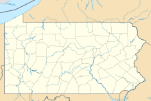
| Map | |||||||||||
| Location of airport in Pennsylvania | |||||||||||
| Runways | |||||||||||
|
|||||||||||
| Statistics (2015) | |||||||||||
|
|||||||||||
|
Source: Federal Aviation Administration
|
|||||||||||
| Aircraft operations | 24,500 |
|---|---|
| Based aircraft | 60 |
Carlisle Airport (Pennsylvania) (IATA: N94, ICAO: None, FAA LID: N94) is a privately owned, public use airport located one nautical miles (two mi, three km) southeast of the central business district of Carlisle, a city in Cumberland County, Pennsylvania, United States. This airport is owned and operated by Business Airport of Carlisle, Inc.
Carlisle Airport covers an area of 114 acres (46 ha) at an elevation of 510 feet (155 m) above mean sea level. It has one runway designated 10/28 with an asphalt surface measuring 4,008 by 60 feet (1,222 x 18 m). The airport has several instrument approaches, including a GPS approach to each runway.
For the 12-month period ending August 28, 2015, the airport had 24,500 aircraft operations, an average of 67 per day: 94% general aviation, 2% air taxi, and 4% military. At that time there were 60 aircraft based at this airport: 83% single-engine, 9% multi-engine, 7% helicopter, and 1% jet.
In January 2016, airport officials announced nearly $4 million in new enhancements to the airport, with the purpose of constructing a corporate aircraft hangar, a medevac hangar and a new terminal building. The goal is to have the project completed by 2020.
...
Wikipedia

