Caramoan, Camarines Sur
| Caramoan | |
|---|---|
| Municipality | |

Caramoan town center
|
|
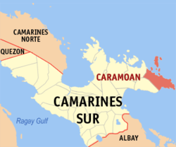
 Map of Camarines Sur showing the location of Caramoan |
|
| Location within the Philippines | |
| Coordinates: 13°46′N 123°52′E / 13.77°N 123.87°ECoordinates: 13°46′N 123°52′E / 13.77°N 123.87°E | |
| Country | Philippines |
| Region | Bicol (Region V) |
| Province | Camarines Sur |
| District | 4th district |
| Barangays | 49 |
| Government | |
| • Councilors |
List
|
| Area | |
| • Total | 276 km2 (107 sq mi) |
| Population (2015 census) | |
| • Total | 47,605 |
| • Density | 170/km2 (450/sq mi) |
| Time zone | PST (UTC+8) |
| ZIP code | 4429 |
| IDD : area code | +63 (0)54 |
| Income class | 1st class |
Caramoan is a first-class municipality in the province of Camarines Sur, Bicol Region, Philippines. It is located at the tip of the Caramoan Peninsula, a rugged place of land extending into the waters of the Maqueda Channel on the north and east and Lagonoy Gulf on the south. According to the 2015 census, it has a population of 47,605 people.
Caramoan is bounded on the north by the town of Garchitorena and the Philippine Sea of the Pacific Ocean; on the north-east by the island province of Catanduanes; on the south by Lagonoy Gulf; on the east by the Maqueda Channel and on the west by the municipality of Presentacion.
The municipality covers approximately 277.41 square kilometres (107.11 sq mi) with approximately 71 kilometres (44 mi) of irregular coastline surrounded by the vast ocean, bay, seas and swamps. It is approximately 500 kilometres (310 mi) from Metro Manila; 95 kilometres (59 mi) from the municipality of Pili, where the seat of the provincial government and the Naga Domestic Airport are located; and 110 kilometres (68 mi) east from Naga City, the heart of Bicol.
Caramoan is politically subdivided into 49 barangays.
Off the coast of the peninsula are numerous small islets. The 10 principal islands of the group are:
The name Caramoan has been officially used since 1619, the year it was named by a Spanish missionary friar, Francisco de la Cruz Y Oropesa. Fr. Oropesa penetrated the thick virgin forest of the Caramoan Peninsula and founded a small settlement in a place called Baluarte. This settlement was subsequently turned over to the administration of the Holy Bishopric in 1696.
...
Wikipedia

