Cape May Historic District
|
Cape May Historic District
|
|
|
Stockton Cottages
|
|
| Location | Cape May, New Jersey |
|---|---|
| Coordinates | 38°56′24″N 74°54′46″W / 38.94000°N 74.91278°WCoordinates: 38°56′24″N 74°54′46″W / 38.94000°N 74.91278°W |
| Area | 380 acres (1.5 km2) |
| Built | 1850 |
| Architectural style | Late Victorian |
| NRHP Reference # | 70000383 |
| NJRHP # | 3042 |
| Significant dates | |
| Added to NRHP | December 29, 1970 |
| Designated NHLD | May 11, 1976 |
| Designated NJRHP | December 10, 1970 |
The Cape May Historic District is an area of 380 acres (1.5 km2) with over 600 buildings in the resort town of Cape May, Cape May County, New Jersey. The city claims to be America's first seaside resort and has numerous buildings in the Late Victorian style, including the Eclectic, Stick, and Shingle styles, as well as the later Bungalow style. According to National Park Service architectural historian Carolyn Pitts, "Cape May has one of the largest collections of late 19th century frame buildings left in the United States... that give it a homogeneous architectural character, a kind of textbook of vernacular American building."
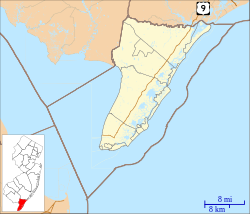
The City of Cape May sits at the south end of Cape May Peninsula which divides the Atlantic Ocean from the Delaware Bay. Cape May Point, about two miles west of the City of Cape May, borders the Bay, while Cape May City borders the Ocean. Cape Island Creek, a tidal "creek" and marsh, originally divided the site of the city from the rest of Cape May, but its southern end has long been covered with landfill. The Cape May Canal, built in 1942, now divides both Cape May City and Cape May Point from the rest of the peninsula.
Cape May was first discovered by Europeans by Henry Hudson on August 28, 1609. He landed on the shore of Delaware Bay a few miles north of Cape May Point before returning to the Atlantic Ocean. Cornelius Mey explored the area further in 1621 for the Dutch West India Company and by May, 1630 Samuel Godyn and Samuel Blommaert bought land for the Dutch from Native Americans covering the southern four miles of the Cape. In 1632 the Dutch established a fishing and whaling settlement in the area, but by 1638 colonists from New England had moved in. By the 1660s the English gained control and Daniel Coxe, a London Quaker, organized a government in 1687. Early settlers worked in the lumber, shipbuilding, whaling, fishing and shellfish industries. A road along the coast built in 1796 helped establish the hamlet of Cape May.
...
Wikipedia


