Cape Hatteras Lighthouse

Cape Hatteras Lighthouse
|
|
| Location | North of Cape Hatteras Point, Outer Banks, Hatteras Island, North Carolina |
|---|---|
| Coordinates | 35°15′01.92″N 75°31′43.74″W / 35.2505333°N 75.5288167°WCoordinates: 35°15′01.92″N 75°31′43.74″W / 35.2505333°N 75.5288167°W |
| Year first constructed | 1802 (original tower) 1870 (current tower) |
| Year first lit | 1803 (original tower) 1870 (current tower) |
| Automated | 1936 (skeleton tower) 1950 (current tower) |
| Foundation | Granite, timber and rubble (first location) Reinforced concrete (current location) |
| Construction | Brick |
| Tower shape | Conical |
| Markings / pattern | Black and white spiral bands with red brick base with granite corners. |
| Height | 210 feet (64 m) |
| Focal height | 187 feet (57 m) |
| Original lens | First order Fresnel, 1870 |
| Current lens | DCB-224 (1970) |
| Range | 24 nautical miles (44 km; 28 mi) |
| Characteristic | Flashing white 7.5 seconds |
| Admiralty number | J2396 |
| ARLHS number | USA-119 |
| USCG number |
2-0625 |
|
Cape Hatteras Light Station
|
|
| Nearest city | Buxton, North Carolina |
| Area | 10 acres (4.0 ha) |
| Built | 1803 |
| NRHP Reference # | 78000266 |
| Added to NRHP | March 29, 1978 |
2-0625
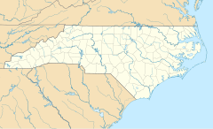
Cape Hatteras Light is a lighthouse located on Hatteras Island in the Outer Banks in the town of Buxton, North Carolina and is part of the Cape Hatteras National Seashore.
The Outer Banks are a group of islands on the North Carolina coast that separate the Atlantic Ocean from the coastal sounds and inlets. Atlantic currents in this area made for excellent travel for ships, except in the area of Diamond Shoals, just offshore at Cape Hatteras. Nearby, the warm Gulf Stream ocean current collides with the colder Labrador Current, creating ideal conditions for powerful ocean storms and sea swells. The large number of ships that ran aground because of these shifting sandbars gave this area the nickname "Graveyard of the Atlantic." It also led Congress to authorize the construction of the Cape Hatteras Light. Its 210-foot height makes it the tallest brick lighthouse structure in the United States and 29th in the world. Since its base is almost at sea level, it is only the 15th highest light in the United States, the first 14 being built on higher ground.
Adjacent to the Cape Hatteras Light is the Hatteras Island Visitor Center and Museum of the Sea, operated by the National Park Service, which is located in the historic Cape Hatteras Lighthouse Double Keepers' Quarters. Exhibits include the history, maritime heritage and natural history of the Outer Banks and the lighthouse. The visitor center offers information about the Cape Hatteras National Seashore, ranger programs and a bookstore.
On July 10, 1794, Congress appropriated $44,000 "for erecting a lighthouse on the head land of Cape Hatteras and a lighted beacon on Shell Castle Island, in the harbor of Ocracoke in the State of North Carolina." The Cape Hatteras Lighthouse was constructed in 1802.
The Cape Hatteras light marked very dangerous shoals which extend from the cape for a distance of 10 nautical miles (19 km). The original tower was built of dark sandstone and retained its natural color. The original light consisted of 18 lamps; with 14-inch (360 mm) reflectors, and was 112 feet (34 m) above sea level. It was visible in clear weather for a distance of 18 miles (29 km).
...
Wikipedia


