Canterbury (district)
| City of Canterbury | |
|---|---|
| Non-metropolitan district, Borough, City | |

|
|
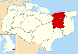
 Canterbury shown within Kent |
|
| Sovereign state | United Kingdom |
| Constituent country | England |
| Region | South East England |
| Non-metropolitan county | Kent |
| Status | Non-metropolitan district, Borough, City |
| Admin HQ | Canterbury |
| Incorporated | 1 April 1974 |
| Government | |
| • Type | Non-metropolitan district council |
| • Body | Canterbury City Council |
| • Leadership | Committee system, Simon Cook (Conservative) |
| • MPs |
Rosie Duffield Roger Gale |
| Area | |
| • Total | 119.24 sq mi (308.84 km2) |
| Area rank | 137th (of 326) |
| Population (mid-2016 est.) | |
| • Total | 162,400 |
| • Rank | 116th (of 326) |
| • Density | 1,400/sq mi (530/km2) |
| • Ethnicity | 93.4% White 2.2% S.Asian 1.6% Chinese and other 1.4% Mixed Race |
| Time zone | GMT (UTC0) |
| • Summer (DST) | BST (UTC+1) |
| ONS code | 29UC (ONS) E07000106 (GSS) |
| OS grid reference | TR145575 |
| Website | www |
The City of Canterbury (RP: /ˈkæntərbəri/ or /ˈkæntərbri/) is a local government district with city status in Kent, England. The main settlement in the district is Canterbury.
The district was formed on 1 April 1974 by the merger of the existing city of Canterbury with the Whitstable and Herne Bay Urban Districts, and Bridge-Blean Rural District. The latter district entirely surrounded the city; the urban districts occupied the coastal area to the north.
Elections to the city council are held every four years, all of the 50 seats on the council being elected. After being under no overall control for a number of years, the Conservative party gained a majority at the 2007 election and increased it in the 2011 election.
...
Wikipedia
