Camp Callan
| Camp Callan | |
|---|---|
| La Jolla, California, U.S. | |
| Coordinates | 32°52′57″N 117°14′45″W / 32.88250°N 117.24583°WCoordinates: 32°52′57″N 117°14′45″W / 32.88250°N 117.24583°W |
| Type | anti-aircraft artillery and coastal artillery replacement training center |
| Site information | |
| Controlled by | United States Army |
| Site history | |
| Built | November 1940 |
| In use | January 15, 1941 – November 1, 1945 |
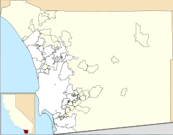
Camp Callan was a United States Army anti-aircraft artillery replacement training center that was operational during World War II. It was located on the southern west coast of the United States, north of San Diego at La Jolla, California. The facility was closed shortly after the war ended and few traces of the base remain.
Camp Callan was located near U.S. Highway 101, about 15 miles (24 km) north of downtown San Diego in the La Jolla area. It occupied a roughly rectangular piece of land approximately 3 miles (5 km) north-to-south and 0.5 miles (0.8 km) east-to-west. This land is on the Torrey Pines Mesa and is near the Pacific Ocean.
The northern portion of the former base is today the 36-hole Torrey Pines Golf Course complex, opened in 1957, and the Torrey Pines State Reserve. The southeastern portion is now part of the University of California, San Diego campus. The rest of the southern portion of the former base includes private land (both residential and commercial), the Scripps Green Hospital and research institutes such as the Salk Institute for Biological Studies. This portion of the former base is in the vicinity of present-day Genesee Avenue and North Torrey Pines Road.
On October 9, 1940, the San Diego City Council leased the U. S. military 710 acres (2.87 km2) of land for a nominal one dollar per year. The city council also leased an additional 0.90 acres (3,640 m2) to the military. Margaret C. Hawkins leased the military 120.08 acres (0.49 km2) and F.T. Scripps, Inc. leased them 72.12 acres (0.29 km2). The military acquired 367.00 acres (1.49 km2) by revocable permit from the city council and 12.85 acres (0.05 km2) by license from the city council. Altogether, 1,282.95 acres (5.19 km2) of land for the base was authorized for acquisition by the government.
...
Wikipedia


