Butaritari

Map of Butaritari
|
|
 |
|
| Geography | |
|---|---|
| Location | Pacific Ocean |
| Coordinates | 3°09′N 172°50′E / 3.150°N 172.833°E |
| Archipelago | Gilbert Islands |
| Area | 13.49 km2 (5.21 sq mi) |
| Highest elevation | 3 m (10 ft) |
| Administration | |
| Demographics | |
| Population | 4,346 (2010 Census) |
| Pop. density | 322 /km2 (834 /sq mi) |
| Ethnic groups | I-Kiribati 99.7% |
Butaritari is an atoll in the Pacific Ocean island nation of Kiribati. The atoll is roughly four-sided. The south and southeast portion of the atoll comprises a nearly continuous islet. The atoll reef is continuous but almost without islets along the north side. Bikati and Bikatieta islets occupy a corner of the reef at the extreme northwest tip of the atoll. Small islets are found on reef sections between channels on the west side. The lagoon of Butaritari is deep and can accommodate large ships, though the entrance passages are relatively narrow. It is the most fertile of the Gilbert Islands, with relatively good soils (for an atoll) and high rainfall. Butaritari atoll has a land area of 13.49 km2 (5.21 sq mi) and a population of 4,346 as of 2010[update]. During World War II, Butaritari was known by US forces as Makin Atoll, and was the site of the Battle of Makin. Locally, Makin is the name of a separate atoll three kilometers to the northeast of Butaritari.
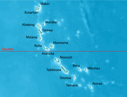
Butaritari is the second most northerly of the Gilbert Islands; three kilometers to the northeast is Makin. Butaritari was called Makin Atoll by the U.S. military, and present-day Makin was then known as Makin Meang (Northern Makin) or Little Makin to distinguish it. Now that Butaritari has become the preferred name for the larger atoll, speakers tend to drop the qualifier for Makin. Butaritari has also previously been known as Pitt Island, Taritari Island, or Touching Island.
The atoll is roughly four-sided and nearly 30 km (19 mi) across in the east-west direction, and averages about 15 km (9 mi) north to south. The reef is more submerged and broken into several broad channels along the west side. Small islets are found on reef sections between these channels. The atoll reef is continuous but almost without islets along the north side. In the northeast corner, the reef is some 1.75 km (1.09 mi) across and with only scattered small islet development. Thus, the lagoon of Butaritari is very open to exchange with the ocean. The lagoon is deep and can accommodate large ships, though the entrance passages are relatively narrow.
...
Wikipedia
