Butano State Park
| Butano Creek State Park | |
|---|---|

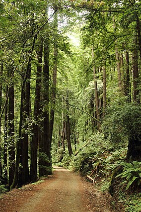
Olmo Fire Road in Butano State Park
|
|
| Location | San Mateo County, California, USA |
| Nearest city | Pescadero, California |
| Coordinates | 37°12′48″N 122°18′35″W / 37.21333°N 122.30972°WCoordinates: 37°12′48″N 122°18′35″W / 37.21333°N 122.30972°W |
| Area | 4,728 acres (19.13 km2) |
| Established | 1956 |
| Governing body | California Department of Parks and Recreation |
Butano State Park is a state park of California, USA, showcasing a secluded redwood-filled canyon. Located in San Mateo County near Pescadero, the 4,728-acre (1,913 ha) park was established in 1956.
The park features miles of hiking trails, 21 drive-in campsites and 18 walk-in campsites. Restrooms with running water are provided. Drinking water is available at the park in both the campground and in the day use areas. There are no showers. Butano also has a backpacking site along a trail 5.5 miles (8.9 km) up from the entrance. There is no water at the site but there is water nearby from seasonal streams.
Guided nature walk and weekend campfire programs are offered during the summer.
Butano as a name has been applied to land grants, creeks, falls, ridges and forests. The earliest mention is by Padre Jaime Escudet in 1816. A butano is what early Californians called a drinking cup made from horn of a bull or other animal. A Native American origin is possible.
...
Wikipedia


