Burrillville, Rhode Island
| Burrillville | |
|---|---|
| Burrillville | |

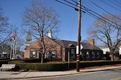
The town office building
|
|
| Motto: "" | |
 Location in Providence County and the state of Rhode Island. |
|
| Coordinates: 41°58′6″N 71°40′59″W / 41.96833°N 71.68306°WCoordinates: 41°58′6″N 71°40′59″W / 41.96833°N 71.68306°W | |
| Country | United States |
| State | Rhode Island |
| County | Providence |
| Incorporated | 1806 |
| Government | |
| • Type | Town meeting |
| • Town Council | Donald A. Fox (R) David J. Place (R) Michelle D. Bouchard (D) Stephen N. Rawson (R) |
| Area | |
| • Total | 57.1 sq mi (148.0 km2) |
| • Land | 55.6 sq mi (143.9 km2) |
| • Water | 1.6 sq mi (4.1 km2) |
| Elevation | 587 ft (179 m) |
| Population (2010) | |
| • Total | 15,955 |
| • Density | 287.0/sq mi (110.9/km2) |
| Time zone | Eastern (EST) (UTC-5) |
| • Summer (DST) | EDT (UTC-4) |
| ZIP code | 02814 (Chepachet), 02826 (Glendale), 02830 (Harrisville), 02839 (Mapleville), 02858 (Oakland), 02859 (Pascoag) |
| Area code(s) | 401 |
| FIPS code | 44-11800 |
| GNIS feature ID | 1220081 |
| Website | Town of Burrillville |
Burrillville is a town in Providence County, Rhode Island, United States. The population was 15,955 at the 2010 census.
It was incorporated as an independent municipality on November 17, 1806 when the Rhode Island General Assembly authorized the residents of then North Glocester to elect its own officers. The town was named for 19th century United States senator James Burrill, Jr. who was then the Rhode Island Attorney General.
Burrilville was probably first settled sometime around 1662, when the first Europeans began to settle the Nipmuc lands. The Town was originally a part of Glocester, Rhode Island. John Smith and members of the Saulsbury family were among the earliest settlers. Samuel Willard (physician) treated many smallpox victims in South Uxbridge and Glocester (Burrillville), and he had the scars to prove it. In 1806, The Town of Burrillville became a separate town and consisted of 60 square miles (160 km2) of land in the northwest corner of Rhode Island, bordering Connecticut and Massachusetts. Later Boundary disputes with Massachusetts and Glocester reduced this land area by the mid-19th century. Joktan Putnam was the first Town moderator. The Nipmuc word for snake was rendered "askug" by Roger Williams in his A Key Into the Language of America, and "askoog" by the Reverend John Eliot in his Algonquian translation of the Bible. Burrillville's principal village, Pascoag, named after the stream upon which it is located, probably derives from this Algonquian root. Gradually in the early-to-mid-19th century, the various mills and villages took shape such as Harris mills, and the village of Harrisville, Mapleville mills, Oakland mills etc. Buck Hill was known for a colorful band of counterfeiters. The town is today part of the Blackstone River Valley National Heritage Corridor, New England's, historic National Park area. Burrillville was home to many historic mills, many of which have either been burned, demolished, abandoned or renovated. The Stillwater Mill Complex in Harrisville is home to the Clocktower apartments, which used to be the old Tinkham textile mills (factual content requested). The site is also home to the recently built Jesse Smith Library.
...
Wikipedia
