Bullet Tree Falls
| Bullet Tree Falls | |
|---|---|

The main bus stop in Bullet Tree Falls
|
|
| Coordinates: 17°10′05″N 89°06′40″W / 17.168°N 89.111°WCoordinates: 17°10′05″N 89°06′40″W / 17.168°N 89.111°W | |
| Country |
|
| District | Cayo District |
| Constituency | Cayo North |
| Elevation | 69 m (226 ft) |
| Population (2010) | |
| • Total | 2,124 |
| Time zone | Central (UTC-6) |
| Climate | Am |
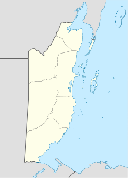
Bullet Tree Falls is a village located along the Mopan River in Cayo District, Belize. It lies approximately five kilometers (three miles) northwest of San Ignacio. According to the 2010 census, Bullet Tree Falls has a population of 2,124 people in 426 households. The population consists mainly of Spanish-speaking mestizos, Yucatec Maya and some Creoles.
Bullet Tree Falls is governed by a seven-person village council. As of 2016, the chairperson of the council is Guotai Wu.
Bullet Tree Falls was originally settled by loggers, and by the late 1800s had attracted a small number of Maya families. During the Caste War of Yucatán numerous Maya refugees from the north settled in the area. The first Creoles settled in Bullet Tree Falls in the 1950s, arriving from San Ignacio.
In 1961, Hurricane Hattie caused significant damage to the village, destroying a school building and church. In 1988, the Salvador Fernandez Bridge was completed, replacing an older wooden bridge. In 2008, Tropical Depression Sixteen caused severe flooding in the area, damaging many homes.
Bullet Tree Falls has developed a small tourist economy facilitated by its location between San Ignacio and the El Pilar Maya archeological site. The village hosts several lodges and a botanical garden. Buses between Bullet Tree Falls and San Ignacio run several times a day and taxi service is available to San Ignacio and El Pilar.
...
Wikipedia

