Buchs, Aargau
| Buchs | ||
|---|---|---|
 |
||
|
||
| Coordinates: 47°23′N 8°05′E / 47.383°N 8.083°ECoordinates: 47°23′N 8°05′E / 47.383°N 8.083°E | ||
| Country | Switzerland | |
| Canton | Aargau | |
| District | Aarau | |
| Area | ||
| • Total | 5.33 km2 (2.06 sq mi) | |
| Elevation | 383 m (1,257 ft) | |
| Population (Dec 2015) | ||
| • Total | 7,731 | |
| • Density | 1,500/km2 (3,800/sq mi) | |
| Postal code | 5033 | |
| SFOS number | 4003 | |
| Surrounded by | Aarau, Rohr, Rupperswil, Suhr | |
| Website |
www SFSO statistics |
|
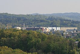
Buchs is a municipality in the district of Aarau of the canton of Aargau in Switzerland.
It is located near the river Suhre and borders with the municipalities of Aarau, Rohr, Rupperswil and Suhr. The municipality is accessed by the A1 motorway via the Aarau-Ost exit.
Buchs is first mentioned in 1225 as Buhse. In 1361 it was mentioned as Buchs.
The blazon of the municipal coat of arms is Argent a Box-tree Vert eradicated issuant from Coupeaux of the same. The coat of arms contains an example of canting, the tree is a box-tree (German: Buchsbaum) which refers to the municipal name.
The center of the village is located at the river Suhre, which joins the river Aare two kilometers farther north. The older populated areas are the "Oberdorf" west of, and the "Ausserdorf" east of, the river; this is surrounded by the newer areas. The area of Buchs lies in the plains of the Suhre, the eastern part is covered by the "Suretwald" forest.
Buchs has an area, as of 2006[update], of 5.3 km2 (2.0 sq mi). Of this area, 13.5% is used for agricultural purposes, while 46.2% is forested. Of the rest of the land, 40.2% is settled (buildings or roads) and the remainder (0.2%) is non-productive (rivers or lakes).
The highest elevation, 394 meters, is located at the south-west border in the "Steinfeld" area, the lowest elevation, 371 meters, is located where the Suhre leaves the area of Buchs in the north.
...
Wikipedia


