Broughton (Milton Keynes)
| Broughton | |
|---|---|
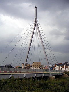
 Bridge in Broughton |
|
| Broughton shown within Buckinghamshire | |
| Population | 2,493 (2011 Census) |
| OS grid reference | SP895399 |
| Civil parish |
|
| Unitary authority | |
| Ceremonial county | |
| Region | |
| Country | England |
| Sovereign state | United Kingdom |
| Post town | MILTON KEYNES |
| Postcode district | MK10 |
| Dialling code | 01908 |
| Police | Thames Valley |
| Fire | Buckinghamshire |
| Ambulance | South Central |
| EU Parliament | South East England |
| UK Parliament | |
Broughton /ˈbrɔːtən/ is a historic village in North Buckinghamshire that has been a constituent element of Milton Keynes since the latter's designation in 1967; a civil parish; and modernly a suburb and new district of the 'city'.
The name is Old English and meant village by the brook. In the Domesday Book, it is listed as owned by a Walter Giffard and the tenant was a Hugh de Bolbec. In the 6th century, its name was spelt Brotone, which is still its customary pronunciation. The original Northampton to London turnpike came through the village (to join Watling Street [now the A5 road] near Woburn). The current main route, the M1 motorway, is very near and Junction 14 is barely half a mile away.
The Milton Keynes grid road, Portway (H5), forms the district's northern boundary and Tongwell Street (V11) provides its western. The section of the old turnpike, once the A50, is now part of the A5130. The original route through centre of the old village, named 'London Road', was bypassed in the early 1970s, the newer route runs between it and another MK district, Brook Furlong, and provides the eastern boundary. Finally, Chaffron Way (H7), provides the southern boundary: in mid-2009 this was extended to meet the A5130 and was opened to traffic in March 2010.
...
Wikipedia

