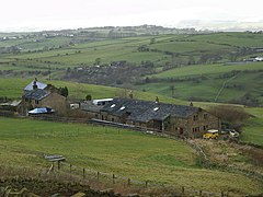
Briercliffe
| Briercliffe with Extwistle | |
|---|---|
 Monk Hall farm |
|
| Briercliffe with Extwistle shown within Lancashire | |
| Population | 4,031 (2011) |
| OS grid reference | SD8749034897 |
| Civil parish |
|
| District | |
| Shire county | |
| Region | |
| Country | England |
| Sovereign state | United Kingdom |
| Post town | BURNLEY |
| Postcode district | BB10 |
| Dialling code | 01282 |
| Police | Lancashire |
| Fire | Lancashire |
| Ambulance | North West |
| EU Parliament | North West England |
| UK Parliament | |
Briercliffe (or Briercliffe-with-Extwistle) is a civil parish in the borough of Burnley, in Lancashire, England. It is situated 3 miles (4.8 km) north of Burnley.
The parish contains suburbs of Burnley (including Harle Syke and Haggate), and the rural area north-east of the town. Hamlets in the parish include Cockden, Lane Bottom and in the Extwistle area, the tiny hamlet of Roggerham.
The parish adjoins the Burnley parish of Worsthorne-with-Hurstwood and the unparished area of Burnley, the Pendle parishes of Brierfield, Nelson and Trawden Forest and West Yorkshire.
According to the United Kingdom Census 2011, the parish has a population of 4,031, an increase from 3,187 in the 2001 census.
Briercliffe-with-Extwistle was once a township in the ancient parish of Whalley, becoming a civil parish in 1866. In 1894 the parish was dissolved, part moving into the county borough of Burnley, with the rest becoming a new parish called Briercliffe, forming part of the Burnley Rural District.
Extwistle Hall stands high on Extwistle Moor between Haggate (east of Brierfield) and the village of Worsthorne. The Hall, built of coursed sandstone on three sides of a courtyard, is now a ruin. It was built in the 16th century in the Tudor style by the Parker family who were prominent in local affairs.
...
Wikipedia

