Brewster, MA
| Brewster, Massachusetts | ||
|---|---|---|
| Town | ||

Linnell Landing Beach, on Cape Cod Bay
|
||
|
||
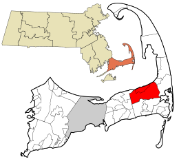
 Location in Barnstable County and the state of Massachusetts. |
||
| Coordinates: 41°45′36″N 70°05′00″W / 41.76000°N 70.08333°WCoordinates: 41°45′36″N 70°05′00″W / 41.76000°N 70.08333°W | ||
| Country | United States | |
| State | Massachusetts | |
| County | Barnstable | |
| Settled | 1656 | |
| Incorporated | 1803 | |
| Government | ||
| • Type | Open town meeting | |
| Area | ||
| • Total | 25.4 sq mi (65.9 km2) | |
| • Land | 22.9 sq mi (59.3 km2) | |
| • Water | 2.5 sq mi (6.6 km2) | |
| Elevation | 39 ft (12 m) | |
| Population (2010) | ||
| • Total | 9,820 | |
| • Density | 429/sq mi (165.7/km2) | |
| Time zone | Eastern (UTC-5) | |
| • Summer (DST) | Eastern (UTC-4) | |
| ZIP code | 02631 | |
| Area code(s) | 508 / 774 | |
| FIPS code | 25-07980 | |
| GNIS feature ID | 0618249 | |
| Website | www |
|
Brewster /ˈbruːstər/ is a town in Barnstable County, Massachusetts, United States, Barnstable County being coextensive with Cape Cod. The population of Brewster was 9,820 at the 2010 census.
Brewster is twinned with the town of Budleigh Salterton in the United Kingdom.
Brewster was first settled in 1656 as a northeastern parish of the town of Harwich. The town separated from Harwich as the northern, more wealthy parish in 1693, and was officially incorporated as its own town in 1803 when the less wealthy citizens of Harwich were upset that the town's institutions were all on Brewster's main street (now Route 6A), including the town hall and churches. Brewster was named in honor of Elder William Brewster, the first religious leader of the Pilgrims at Plymouth Colony. The town's history grew around Stony Brook, where the first water-powered grist and woolen mill in the country was founded in the late 17th century. There were many rich sea captains in the town, who built many of the mansions and stately homes which now constitute the town's inns and bed-and-breakfasts. Most notable of these are the Crosby Mansion on Crosby Lane by Crosby Beach, which is currently undergoing renovations to allow for more weddings and other functions, and the Captain Freeman Inn on Breakwater Road.
According to the United States Census Bureau, the town has a total area of 25.4 square miles (65.9 km2), of which 22.9 square miles (59.3 km2) is land and 2.5 square miles (6.6 km2), or 10.07%, is water.
...
Wikipedia

