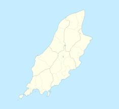
Brandywell, Isle of Man
| Brandywell, Isle of Man | |
|---|---|

B10 Beinn-y-Phott Road looking towards Brandywell, Slieau Dhoo mountain and Mount Karin.
|
|
| Coordinates | 54°14′53.9″N 4°32′27.3″W / 54.248306°N 4.540917°WCoordinates: 54°14′53.9″N 4°32′27.3″W / 54.248306°N 4.540917°W |
| Built | 1864-65, 1894-96, 1935, 1938 |
Brandywell, Isle of Man (Manx: Chibbyr-y-Phunch) (archaic|Chibbyr Slieau Maggle) is an area of Mountain Lands of heath moorland and coniferous woodland plantations situated in the Northern Upland Massif in the parish of Kirk Michael in the Isle of Man.
The area of Brandywell is open moorland situated in the Northern Uplands of the Isle of Man including the commons grazing land of North Park (archaic|’Slieau Maggle’) and Injerbreck Hill close to the private residence of ‘Brandywell Cottage’ a former Mountain Shepherd’s Cottage.
The area of Brandywell includes the secondary B10 Beinn-y-Phott Road, the B25 West Baldwin Road, B10 Brandywell / Sartfell Road with the junction with the B26 Ballaugh Glen (Druidale) Road at ‘Brandywell Cottage.’ The area is dominated by the nearby Snaefell Mountain with an elevation of 621m (2,036 feet) above sea level and the nearby summits of Beinn-y-Phott (544m), Sartfell (454 m) Slieau-ny-Maggle (427m) and nearby Injerbreck Hill.
The Brandywell Corner, previously the Mountain Gate or Iron Gate, is the site of a former parish boundary marker cairn and gates for the Crown Commons land of Beinn-y-Phott mountain. It is located between the 6th Milestone and 7th Milestone road-side markers on the primary A18 Snaefell Mountain Road and with the road junction with the secondary B10 Beinn-y-Phott road or Brandywell Road in the parish of Kirk Lonan with the adjoining boundary-line for the parishes of Kirk Braddan and Christ Kirk Lezayre in the Isle of Man.
The publication, A Gazetteer of the Isle of Man writes that the;- “….Brandywell Road ….This name has been adopted by the motor cycle fraternity for the sweeping left hand bend…..where the B10 leaves the TT course (A18) a short distance on from Hailwood Rise. The OS Landranger Map 95 further confuses by marking this place as Brandywell.”
The name Brandywell originates from a nearby water-well. For the adjacent property of ‘Brandywell Cottage,’ the publication, A Gazetteer of the Isle of Man writes about a local story;- “…a rich Manxman, who had been successful abroad, hired men to work here. To demonstrate his wealth, he filled the local well with Brandy.”
Brandywell in the parish of Kirk Michael was also a place where local mountain shepherds would gather to celebrate Forester’s Day and to brand and sort flocks of mountain sheep including the castration of male lambs.
...
Wikipedia

