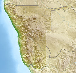
Brandberg Massif
| Brandberg | |
|---|---|

The Brandberg Massif viewed from the south at sunset
|
|
| Highest point | |
| Elevation | 2,573 m (8,442 ft) |
| Prominence | 1,802 m (5,912 ft) |
| Listing |
Country high point Ultra |
| Coordinates | 21°08′57″S 14°34′39″E / 21.14917°S 14.57750°ECoordinates: 21°08′57″S 14°34′39″E / 21.14917°S 14.57750°E |
| Naming | |
| Translation | Fire Mountain (German) |
| Geography | |
| Location | Erongo, Namibia |
| Climbing | |
| Easiest route | Ga'aseb River Valley |
The Brandberg (Damara: Dâures; Otjiherero: Omukuruvaro), is Namibia's highest mountain.
Brandberg Mountain is located in former Damaraland, now Erongo, in the northwestern Namib Desert, near the coast, and covers an area of approximately 650 km². With its highest point, the Königstein (German for 'King's Stone'), standing at 2,573 m (8,442 ft) above sea level and located on the flat Namib gravel plains, on a clear day 'The Brandberg' can be seen from a great distance. There are various routes to the summit, the easiest (also steepest) being up the Ga'aseb river valley, but other routes include the Hungurob and Tsisab river valleys. The nearest settlement is Uis, roughly 30 km from the mountain.
The name Brandberg is Afrikaans, Dutch and German for Fire Mountain, which comes from its glowing color which is sometimes seen in the setting sun. The Damara name for the mountain is Dâures, which means 'burning mountain', while the Herero name, Omukuruvaro means 'mountain of the Gods'.
The Brandberg Massif or Brandberg Intrusion is a granitic intrusion, which forms a dome-shaped massif. It originated during Early Cretaceous rifting that led to the opening of the South Atlantic Ocean. Argon–argon dating yielded intrusive ages of 132 to 130 Ma. The dominant plutonic rock is a homogeneous medium grained biotite-hornblende granite. In the western interior of the massif (Naib gorge), a 2 km in diameter body of pyroxene-bearing monzonite is exposed. The youngest intrusive rocks based on cross-cutting relations are arfvedsonite granite dikes and sills in the southwestern periphery of the Brandberg massif which crop out in the Amis valley. The arfvedsonite granites contain minerals rich in rare earth element minerals such as pyrochlore and bastnaesite. Remnants of Cretaceous volcanic rocks are preserved in a collar along the western and southern margins of the massif. Their angle of dip increases towards the contact where clasts of country-rock occur within the granite forming a magmatic breccia. The origins of the magmas that formed the Brandberg intrusion are related to emplacement of mantle-derived basaltic magma during continental break-up which led to partial melting of crustal rocks resulting in a hybrid granitic magma. Erosion subsequently removed the overburden rock. Apatite fission track dating indicates approximately 5 km denudation between 80 and 60 Ma.
...
Wikipedia

