Bournemouth West (UK Parliament constituency)
| Bournemouth West | |
|---|---|
|
Borough constituency for the House of Commons |
|

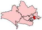
Boundary of Bournemouth West in Dorset.
|
|

Location of Dorset within England.
|
|
| County | Dorset |
| Population | 98,968 (2011 census) |
| Electorate | 72,714 (December 2010) |
| Current constituency | |
| Created | 1950 |
| Member of parliament | Conor Burns (Conservative) |
| Number of members | One |
| Overlaps | |
| European Parliament constituency | South West England |
Coordinates: 50°43′01″N 1°54′47″W / 50.717°N 1.913°W
Bournemouth West is a borough constituency represented in the House of Commons of the Parliament of the United Kingdom. It elects one Member of Parliament (MP) by the first past the post system of election.
1950-1974: The County Borough of Bournemouth wards of Central, East Cliff, Kinson, Moordown North, Moordown South, Redhill Park, Westbourne, West Cliff, and Winton.
1974-1983: The County Borough of Bournemouth wards of Central, East Cliff, Kinson North, Kinson South, Redhill Park, Westbourne, West Cliff, and Winton.
1983-1997: The Borough of Bournemouth wards of Ensbury Park, Kinson, Redhill Park, Talbot Woods, Wallisdown, Westbourne, West Cliff, and Winton, and the Borough of Poole wards of Alderney, Bourne Valley, and Canford Magna.
1997-2010: The Borough of Bournemouth wards of Central, East Cliff, Ensbury Park, Kinson, Redhill Park, Talbot Woods, Wallisdown, Westbourne, West Cliff, and Winton.
2010–present: The Borough of Bournemouth wards of Central, Kinson North, Kinson South, Redhill and Northbourne, Talbot and Branksome Woods, Wallisdown and Winton West, Westbourne and West Cliff, and Winton East, and the Borough of Poole wards of Alderney and Branksome East.
The constituency includes the western portion of Bournemouth, from the Kinson, Winton, and Talbot Woods areas down towards the town centre and the West Cliff. Following a boundary change for the 2010 General Election, the constituency gained the Branksome area from Poole whilst losing East Cliff to the neighbouring Bournemouth East constituency.
...
Wikipedia
