Boulder Reservoir
| Boulder Reservoir | |
|---|---|
| Boulder City Reservoir | |

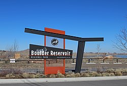
The entrance sign.
|
|
| Location | Boulder, Colorado |
| Coordinates | 40°04′42″N 105°13′19″W / 40.07833°N 105.22194°WCoordinates: 40°04′42″N 105°13′19″W / 40.07833°N 105.22194°W |
| Managing agency | Northern Colorado Water Conservancy District |
| Built | May 1, 1954 |
| First flooded | February 11, 1955 |
| Water volume | 13,270 acre⋅ft (16.37×10⁶ m3) |
| Surface elevation | 1,578 m (5,177 ft) |
Boulder Reservoir is located in the northern part of Boulder, Colorado. It stores water for the Northern Colorado Water Conservancy District — also called Northern Water — and for the City of Boulder. The reservoir is the centerpiece of the Boulder Reservoir Regional Park, which is managed by the City of Boulder's Department of Parks and Recreation.
The reservoir receives most of its water from Colorado's Western Slope through the Alva B. Adams Tunnel and the Boulder Feeder Canal, both part of the Colorado-Big Thompson Project. Some of the stored water is used as part of Boulder's municipal water supply and some is used for agricultural purposes in Boulder and Weld counties.
The reservoir's surface area is 700 acres. According to Boulder's Parks and Recreation Department, the chief recreation activities at the park are "boating, swimming, sun bathing, water skiing, fishing, picnics, walking, running, cycling and wildlife viewing."
The reservoir is popular among anglers, especially those fishing for walleye, smallmouth bass, and catfish. In recent years, the State of Colorado has stocked the reservoir with black crappie, saugeye, and rainbow trout. Ice fishing is also possible when the lake is frozen.
The reservoir was completed in 1955.
...
Wikipedia
