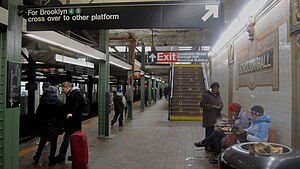
Borough Hall (IRT Broadway–Seventh Avenue Line)
|
Court Street–Borough Hall
|
|||
|---|---|---|---|
| New York City Subway rapid transit station complex | |||
 |
|||
| Station statistics | |||
| Address | Court Street between Joralemon Street & Montague Street Brooklyn, NY 11201 |
||
| Borough | Brooklyn | ||
| Locale | Downtown Brooklyn, Brooklyn Heights | ||
| Coordinates | 40°41′37″N 73°59′25″W / 40.693655°N 73.990216°WCoordinates: 40°41′37″N 73°59′25″W / 40.693655°N 73.990216°W | ||
| Division | A (IRT), B (BMT) | ||
| Line |
BMT Fourth Avenue Line IRT Broadway–Seventh Avenue Line IRT Eastern Parkway Line |
||
| Services |
2 3 4 5 N R W |
||
| Transit connections |
|
||
| Levels | 3 | ||
| Other information | |||
| Opened | July 1, 1948 | ||
| Wireless service | |||
| Traffic | |||
| Passengers (2015) | 11,360,058 (station complex) |
||
| Rank | 27 out of 425 | ||
|
|||
|
Borough Hall
|
|||||||||
|---|---|---|---|---|---|---|---|---|---|
| New York City Subway rapid transit station | |||||||||

|
|||||||||
| Station statistics | |||||||||
| Division | A (IRT) | ||||||||
| Line | IRT Broadway–Seventh Avenue Line | ||||||||
| Services |
2 3 |
||||||||
| Structure | Underground | ||||||||
| Levels | 2 | ||||||||
| Platforms | 2 side platforms (1 on each level) | ||||||||
| Tracks | 2 (1 on each level) | ||||||||
| Other information | |||||||||
| Opened | April 15, 1919 | ||||||||
| Accessible | |||||||||
| Wireless service | |||||||||
| Station succession | |||||||||
| Next north |
Clark Street: 2 |
||||||||
| Next south |
Hoyt Street: 2 |
||||||||
|
|
|
||||||||
| Next |
Fulton Street: 2 |
||||||||
| Next |
Atlantic Avenue–Barclays Center: 2 |
||||||||
|
|||||||||
|
Borough Hall
|
|
|---|---|
| New York City Subway rapid transit station | |
 |
|
| Station statistics | |
| Division | A (IRT) |
| Line | IRT Eastern Parkway Line |
| Services |
4 5 |
| Structure | Underground |
| Platforms | 2 side platforms |
| Tracks | 2 |
| Other information | |
| Opened | January 9, 1908 |
| Accessible |
|
| Wireless service | |
| Station succession | |
| Next north |
Bowling Green: 4 |
| Next south |
Nevins Street: 4 |
|
|
|
| Next |
Bowling Green: 4 |
| Next |
station not accessible southbound Previous accessible station northbound: Atlantic Avenue–Barclays Center: 4
...
|


