Booie, Queensland
|
Booie Kingaroy, Queensland |
|||||||||||||
|---|---|---|---|---|---|---|---|---|---|---|---|---|---|

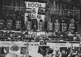
Booie and Malah districts exhibition at Kingaroy Show, 1936
|
|||||||||||||
| Population | 912 (2011) | ||||||||||||
| Postcode(s) | 4610/4615 | ||||||||||||
| LGA(s) | South Burnett Region | ||||||||||||
| State electorate(s) | Nanango | ||||||||||||
| Federal Division(s) | Maranoa | ||||||||||||
|
|||||||||||||
Booie is a rural locality on the boundary of Kingaroy and Nanango in the South Burnett Region, Queensland, Australia. In the 2011 census, the population was 912 people.
The name Booie derives from the name of a pastoral run, which is believed to be a Wakawaka language word meaning carpet snake.
A provisional school had been established by 1893. In 1905, a new Booie State School was erected. Booie State School closed in 1963.
In June 1954, Booie hit the news after local boys claimed to have seen a two-legged monster in a cave. Despite searching by experienced bushman, the monster was not found and it was speculated that the boys had seen a large kangaroo.
Coordinates: 26°31′59″S 151°56′00″E / 26.53306°S 151.93333°E
...
Wikipedia
