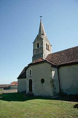
Bonvillars
| Bonvillars | ||
|---|---|---|
 |
||
|
||
| Coordinates: 46°50′N 6°40′E / 46.833°N 6.667°ECoordinates: 46°50′N 6°40′E / 46.833°N 6.667°E | ||
| Country | Switzerland | |
| Canton | Vaud | |
| District | Jura-Nord Vaudois | |
| Government | ||
| • Mayor | Syndic | |
| Area | ||
| • Total | 7.54 km2 (2.91 sq mi) | |
| Elevation | 475 m (1,558 ft) | |
| Population (Dec 2015) | ||
| • Total | 503 | |
| • Density | 67/km2 (170/sq mi) | |
| Postal code | 1427 | |
| SFOS number | 5551 | |
| Surrounded by | Champagne, Cheseaux-Noréaz, Concise, Corcelles-près-Concise, Fontanezier, Grandson, Onnens, Provence | |
| Website |
www Profile (French), SFSO statistics |
|
Bonvillars is a municipality in the district of Jura-Nord Vaudois in the canton of Vaud in Switzerland.
Bonvillars is first mentioned in 1100 AD as Binvilar.
Local Savoyard Knight Sir John de Bonvillars (Sir Jean de Bevillard in French) was brother in law to nearby Otton de Grandson of Grandson Castle. Sir John was a household knight in the service of King Edward I of England. Bonvillars held the post of Deputy Justicier of Wales prior to being First Constable of Harlech Castle from 1285 to his death by drowning (probably during siege of Dryslwyn in South Wales) between July and November 1287. Married to Agnes de Bevillard (likely sister of Otto de Grandson).
Bonvillars has an area, as of 2009[update], of 7.54 square kilometres (2.91 sq mi). Of this area, 3.66 km2 (1.41 sq mi) or 48.5% is used for agricultural purposes, while 3.29 km2 (1.27 sq mi) or 43.6% is forested. Of the rest of the land, 0.48 km2 (0.19 sq mi) or 6.4% is settled (buildings or roads), 0.05 km2 (12 acres) or 0.7% is either rivers or lakes.
Of the built up area, housing and buildings made up 1.9% and transportation infrastructure made up 2.7%. Out of the forested land, 41.9% of the total land area is heavily forested and 1.7% is covered with orchards or small clusters of trees. Of the agricultural land, 23.7% is used for growing crops and 13.5% is pastures, while 6.0% is used for orchards or vine crops and 5.3% is used for alpine pastures. All the water in the municipality is flowing water.
The municipality was part of the Grandson District until it was dissolved on 31 August 2006, and Bonvillars became part of the new district of Jura-Nord Vaudois.
The municipality is located at the foot of the Jura Mountains and stretches from Lake Neuchatel to Mont Aubert. It consists of the village of Bonvillars and the settlements of La Coudre and Les Vullierens.
...
Wikipedia


