Boley, Oklahoma
| Boley, Oklahoma | |
|---|---|
| Town | |

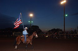
Boley 100th Birthday Rodeo & Bar-B-Q Festival
|
|
 Location of Boley, Oklahoma |
|
| Coordinates: 35°29′34″N 96°28′54″W / 35.49278°N 96.48167°WCoordinates: 35°29′34″N 96°28′54″W / 35.49278°N 96.48167°W | |
| Country | United States |
| State | Oklahoma |
| County | Okfuskee |
| Area | |
| • Total | 1.6 sq mi (4.3 km2) |
| • Land | 1.6 sq mi (4.3 km2) |
| • Water | 0.0 sq mi (0.0 km2) |
| Elevation | 892 ft (272 m) |
| Population (2010) | |
| • Total | 1,184 |
| • Density | 740.0/sq mi (275.3/km2) |
| Time zone | Central (CST) (UTC-6) |
| • Summer (DST) | CDT (UTC-5) |
| ZIP code | 74829 |
| Area code(s) | 539/918 |
| FIPS code | 40-07500 |
| GNIS feature ID | 1090385 |
Boley is a town in Okfuskee County, Oklahoma, United States. The population was 1,184 at the 2010 census, a gain of 5.2 percent from 1,126 in 2000. Boley was established in 1903 as a predominantly Black pioneer town with Native American ancestry among its citizens.
The Boley Public School District is one of the smallest public school districts in the state of Oklahoma. For the most recent data available, it tied with Sweetwater for the smallest high school with 15 students. For a combined district, K-12, Boley finished first, just ahead of Clarita (58) and Sweetwater (60), with 51 students. Boley is also home to BBQ equipment maker, Smokaroma, Inc, and the John Lilley Correctional Center. The Boley Historic District is a National Historic Landmark. Currently Boley hosts The Annual Boley Rodeo & Bar-B-Que Festival.
This area was settled by Creek Freedmen, whose ancestors had been held as slaves of the Creek at the time of Indian Removal in the 1830s. After the American Civil War, the United States negotiated new treaties with tribes that allied with the Confederacy. It required them to emancipate their slaves and give them membership in the tribes. Those formerly slaves were called the Creek Freedmen. At the time of allotments to individual households under the Dawes Commission, Creek Freedmen were registered as such on the Dawes Rolls (even if they were of mixed-race and also descended directly from Creek ancestors.) Creek Freedmen set up independent townships, of which Boley was one. The town was established on the land allotted to Abigail Barnett, daughter of James Barnett, a Creek freedman.
The coming of the Fort Smith & Western Railroad allowed agricultural land to be more profitably used as a townsite. Property owned by the Barnett family, among other Creek Freedmen, was midway between Paden and Castle, and ideal for a station stop. With the approval of the railroad management, Boley, Creek Nation, Indian Territory was incorporated in 1905. It was named for J. B. Boley, an official of the railroad. There were no other African-American towns nearby, it became a center of regional business. During the early part of the 20th century, Boley was one of the wealthiest Negro towns in the US. It boasted the first nationally chartered bank owned by blacks, and its own electric company. The town had over 4,000 residents by 1911, and was the home of two colleges: Creek-Seminole College, and Methodist Episcopal College. The Masonic Lodge was called "the tallest building between Okmulgee and Oklahoma City," when it was built in 1912.Booker T. Washington visited Boley in 1905, and was so impressed that he included Boley in his speeches.
...
Wikipedia
