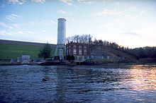
Blue Ridge Dam
| Blue Ridge Dam | |
|---|---|
 |
|
| Official name | Blue Ridge Dam |
| Location | Fannin County, Georgia, United States |
| Coordinates | 34°52′57″N 84°16′48″W / 34.88250°N 84.28000°WCoordinates: 34°52′57″N 84°16′48″W / 34.88250°N 84.28000°W |
| Construction began | 1925 |
| Opening date | July 31, 1931 |
| Operator(s) | Tennessee Valley Authority |
| Dam and spillways | |
| Impounds | |
| Height | 167 feet (51 m) |
| Length | 1,000 feet (300 m) |
| Reservoir | |
| Creates | Lake Blue Ridge |
Blue Ridge Dam is a hydroelectric dam on the in Fannin County, in the U.S. state of Georgia. It is the uppermost of four dams on the Toccoa/Ocoee River owned and operated by the Tennessee Valley Authority. The dam impounds the 3,300-acre (1,300 ha) Blue Ridge Lake on the southwestern fringe of the Blue Ridge Mountains.
Blue Ridge Dam is located 51 miles (82 km) upstream from the mouth of the Toccoa/Ocoee River, near the point where the states of Georgia, Tennessee, and North Carolina meet. The Toccoa River winds its way northwestward from the dam, crossing into Tennessee (where it becomes the Ocoee River) roughly 10 miles (16 km) downstream en route to the on the lower part of the river. Blue Ridge Dam is 23 miles (37 km) upstream from Ocoee Dam No. 3. The Chattahoochee National Forest surrounds Blue Ridge Dam and its reservoir, and the city of Blue Ridge, Georgia is located a few miles west of the dam. U.S. Route 76 crosses a bridge just downstream from Blue Ridge Dam.
Blue Ridge Dam is a hydraulic earth-fill type dam 167 feet (51 m) high and 1,000 feet (300 m) long, and has a generating capacity of 22 megawatts. The dam's gate-controlled saddle spillway— which is separated from the main dam by a small hill— can discharge up to 55,000 cubic feet (1,600 m3) of water per second. The dam's powerhouse utilizes a 192-foot (59 m) concrete intake tower, and a 14-foot (4.3 m)-diameter steel 1,050 feet (320 m) long that conveys water from the tower to the primary turbine. A 180-foot (55 m) surge tank relieves pressure brought about by rapid gate closures.
Blue Ridge Lake has approximately 60 miles (97 km) of shoreline and a flood storage capacity of 68,550 acre feet (84,560,000 m3). The reservoir's levels fluctuate by about 20 feet (6.1 m) in a typical year. Seasonal releases from the dam create Class I and Class II rapids on the Toccoa River for several miles downstream.
...
Wikipedia
