Blatnice pod Svatým Antonínkem
| Blatnice pod Svatým Antonínkem | |||
|---|---|---|---|
| Village | |||
 |
|||
|
|||
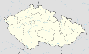
| Location in the Czech Republic | |||
| Coordinates: 48°56′45″N 17°27′50″E / 48.94583°N 17.46389°E | |||
| Country |
|
||
| Region | South Moravian Region | ||
| District | Hodonín District | ||
| Area | |||
| • Total | 5.37 sq mi (13.92 km2) | ||
| Elevation | 702 ft (214 m) | ||
| Population (1.1.2012) | |||
| • Total | 2,106 | ||
| • Density | 390/sq mi (150/km2) | ||
| Time zone | CET (UTC+1) | ||
Blatnice pod Svatým Antonínkem is a village in Hodonín County in the South Moravian Region of the Czech Republic. As of 2008 it had a population of 2,124.
The village was first mentioned in 1046. The village is known for its wine, which has a rich tradition, and has its own brand of wine Blatnický Roháč. People in the village produce wine in traditional wine cellars, of which the oldest were built at the end of the 16th or at the beginning of the 17th century.
In the village proper, there is a church of St. Andrew. On the hill over the village, there is a small church of St. Anthony, built in the 17th century, local centre of pilgrimage. In the village, there are also a primary school, and all civic facilities.
Hundreds of residents of Blatnice emigrated to the United States in the late 19th and early 20th centuries. Destinations included the states of Michigan, Wisconsin, Iowa and Illinois, mainly centering in and around Chicago. Many of them were welcomed by former Blatnice residents, František Cícha, Antonin Valášek and František and Mary (Cicha) Vyskočil at the Moravsky Dům on 26th Street in Chicago to the United States. This club provided Moravian social interaction to the newcomers. Surnames associated with these immigrants were:
Budinek, Cicha, Fajkus, Fnasek, Gal, Hanacek, Hejtmanek, Kalina, Kalisek, Macal, Misek, Najdal, Nemcicky, Nemecek, Petratur, Pospisil, Stanek, Valasek, Vybiral, Vyskocil Coordinates: 48°56′45″N 17°27′50″E / 48.94583°N 17.46389°E
...
Wikipedia


