Birrhard
| Birrhard | ||
|---|---|---|
 |
||
|
||
| Coordinates: 47°26′N 8°15′E / 47.433°N 8.250°ECoordinates: 47°26′N 8°15′E / 47.433°N 8.250°E | ||
| Country | Switzerland | |
| Canton | Aargau | |
| District | Brugg | |
| Area | ||
| • Total | 12.48 km2 (4.82 sq mi) | |
| Elevation | 390 m (1,280 ft) | |
| Population (Dec 2015) | ||
| • Total | 15,600 | |
| • Density | 1,300/km2 (3,200/sq mi) | |
| Postal code | 5244 | |
| SFOS number | 4082 | |
| Surrounded by | Birmenstorf, Birr, Brunegg, Lupfig, Mägenwil, Mülligen, Wohlenschwil | |
| Website |
www SFSO statistics |
|
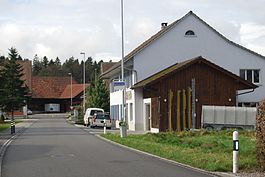
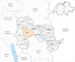
Birrhard is a municipality in the district of Brugg in canton of Aargau in Switzerland.
It is located about 5 km (3.1 mi) south east of the town of Brugg.
Birrhard is first mentioned in 1254 as Birharth when it belonged to the Habsburgs. The authority over the village went to the monastery Königsfelden in Windisch in 1397. After the secularization of the monastery in 1528, the authority went to Bern.
Birrhard has an area, as of 2007[update], of 2.99 square kilometers (1.15 sq mi). Of this area, 1.58 square kilometers (0.61 sq mi) or 52.8% is used for agricultural purposes, while1.01 square kilometers (0.39 sq mi) or 33.8% is forested. Of the rest of the land, 0.37 square kilometers (0.14 sq mi) or 12.4% is settled (buildings or roads), 0.05 km2 (12 acres) or 1.7% is either rivers or lakes. Of the built up area, industrial buildings made up 0.7% of the total area while housing and buildings made up 6.0% and transportation infrastructure made up 4.7%.. 32.8% of the total land area was heavily forested. Of the agricultural land, 46.2% is used for growing crops and 5.7% is pastures. All the water in the municipality is in rivers and streams.
The municipality is made up of the communities of Ausserdorf, Unterdorf (both part of the linear village of Birrhard) and the hamlets of Inlauf. It is located on the eastern edge of the expansive and mainly agriculture Birrfeld region. Just to the east of the town the plain drops about 50 meters (160 ft) to the banks of the Reuss river. The Reuss forms the eastern boundary of the municipality, and, in this area, flows through a valley about 100 meters (330 ft) wide. The highest point has an elevation of 412 meters (1,352 ft), and the lowest elevation, along the Reuss, is 340 meters (1,120 ft).
...
Wikipedia


