Bhuj Airport
| Bhuj Airport | |||||||||||
|---|---|---|---|---|---|---|---|---|---|---|---|
 |
|||||||||||
| Summary | |||||||||||
| Airport type | Military/Public | ||||||||||
| Operator | |||||||||||
| Serves | Bhuj | ||||||||||
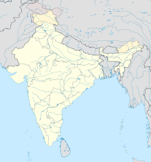
| Location | Bhuj, Kutchh District | ||||||||||
| Elevation AMSL | 257 ft / 78 m | ||||||||||
| Coordinates | 23°17′16″N 069°40′13″E / 23.28778°N 69.67028°ECoordinates: 23°17′16″N 069°40′13″E / 23.28778°N 69.67028°E | ||||||||||
| Map | |||||||||||
| Runways | |||||||||||
|
|||||||||||
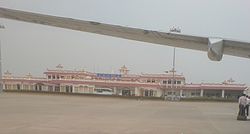
Bhuj Airport (IATA: BHJ, ICAO: VABJ) is a domestic airport located in Bhuj in the Kutch District of the state of Gujarat, India.
It is situated at an altitude of 257 feet (78 m) and occupies a total area of 832 acres (337 ha). It is located 30 miles (48 km) from the Indo-Pakistan border.
The airport was previously made up of two bunkers/buildings near the Bhuj Rudra Mata Air Force Base, with which it shares the runway. On one side of the passing road there was an Indian Airlines bunker, and on the other side a Jet Airways bunker. From there a coach would transport passengers across the Indian Air Force grounds to the small departures terminal.
The airstrip was destroyed in the Indo-Pakistani War of 1971, in air strikes in which Pakistani bombers dropped napalm bombs. The airfield was raided 35 times in 14 days with attacks by 92 bombs and 22 rockets. It was rebuilt during wartime by a group of 300 women from the nearby village of Madhapar who were given 72 hours to complete the task. Later the Government of India honoured these women with a cash prize of ₹ 50,000.
The airport was damaged in the 2001 Gujarat earthquake and was renovated at a cost of ₹400 million. The renovated terminal was dedicated in 2003 by then Deputy Prime Minister of India, Lal Krishna Advani.
...
Wikipedia


