Betschwanden
| Betschwanden | ||
|---|---|---|
| Village (and former municipality) | ||
 |
||
|
||
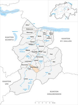
 The former municipal area (2007) |
||
| Coordinates: 46°57′4″N 9°01′53″E / 46.95111°N 9.03139°ECoordinates: 46°57′4″N 9°01′53″E / 46.95111°N 9.03139°E | ||
| Country | Switzerland | |
| Canton | Glarus | |
| Municipality | Glarus Süd | |
| Area | ||
| • Total | 9.74 km2 (3.76 sq mi) | |
| Elevation | 600 m (2,000 ft) | |
| Population (December 2010) | ||
| • Total | 182 | |
| • Density | 19/km2 (48/sq mi) | |
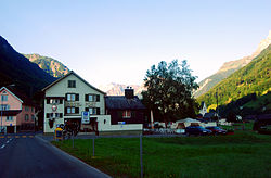
Betschwanden is a village, and former municipality, in the municipality of Glarus Süd and canton of Glarus in Switzerland.
Betschwanden is first recorded in 1240 in the phrase in Beswando.
Until 1395, Betschwanden was obliged to pay tithes and taxes to Säckingen Abbey. At the same time it was part of the parish of Glarus. The village church was built in the Romanesque style in the 14th century. It was rebuilt several times and flood control walls were added in 1779-80. The Art Nouveau and Gothic Revival elements were added in 1915 and restored in 1975-77. The exterior of the church was rebuilt in 2001.
When the Protestant Reformation arrived in Glarus, Betschwanden adopted the new faith. In 1528 it joined a Reformed parish with Braunwald, Hätzingen, Diesbach and Rüti. In 1942 Braunwald separated to form an independent parish.
Until the 19th century, alpine farming and herding was the primary source of income. A mill was built on the Diesbach river in 1778. Today it is a guest house for the rectory. A parish school opened in 1727. A secondary school opened in 1844. A spinning mill opened in 1843 and a warehouse was added in 1910; it is now a textile chemical factory. A station of the Schweizerische Nordostbahn (Swiss North-East Railway) opened in the village in 1879.
On 1 January 2011, the municipality of Betschwanden was merged into the new municipality of Glarus Süd.
Betschwanden is located in the valley of the Linth river, with the village situated on the east bank of the river, at an elevation of approximately 600 m (2,000 ft). The village of Rüti lies to the south and Diesbach to the north. Above the village to the east is the mountain of Kärpf (2,794 m or 9,167 ft).
...
Wikipedia

