Berrinba, Queensland
|
Berrinba Logan City, Queensland |
|||||||||||||
|---|---|---|---|---|---|---|---|---|---|---|---|---|---|

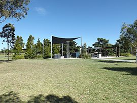
Berrinba Wetlands picnic area, 2014
|
|||||||||||||
| Coordinates | 27°39′39″S 153°4′45″E / 27.66083°S 153.07917°ECoordinates: 27°39′39″S 153°4′45″E / 27.66083°S 153.07917°E | ||||||||||||
| Population | 1,382 (2011 census) | ||||||||||||
| Postcode(s) | 4117 | ||||||||||||
| Location | 24 km (15 mi) from Brisbane CBD | ||||||||||||
| LGA(s) | |||||||||||||
| State electorate(s) | Stretton | ||||||||||||
| Federal Division(s) | Moreton, Rankin | ||||||||||||
|
|||||||||||||
Berrinba is a suburb in Logan City, Queensland, Australia. Berrinba was once also within the City of Brisbane but that part of the suburb has been renamed Karawatha. At the 2011 Australian Census the suburb recorded a population of 1,382.
The naming of the suburb Berrinba is originated from an Aboriginal word meaning to indicate towards the south for example to the left of a speaker with the sunrise behind him/her.
In the 2011 census, Berrinba recorded a population of 1,382 people, 51.7% female and 48.3% male. The median age of the Berrinba population was 30 years of age, 7 years below the Australian median. 59.6% of people living in Berrinba were born in Australia, compared to the national average of 69.8%; the next most common countries of birth were New Zealand 6.5%, England 2.7%, India 2%, South Africa 1.8%, Fiji 1.7%. 67.5% of people spoke only English at home; the next most popular languages were 3% Mandarin, 2.2% Cantonese, 2.2% Hindi, 2.2% Arabic, 2.2% Samoan.
Berrinba Wetlands is a man-made recreational park covering 120 ha along Scrubby Creek. Scrubby Creek joins Slacks Creek which enters the Logan River. The park contains 8.5 km of walkways and bike tracks, nesting boxes and substantial bridges designed to collapse during flooding if required. Non-native trees have been removed and more than 400,000 native plants were planted.
...
Wikipedia

