Berkner Island

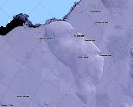
LIMA Satellite image of Berkner Island, Antarctica
|
|
| Location in Antarctica | |
| Geography | |
|---|---|
| Location | Antarctica |
| Coordinates | 79°30′S 47°30′W / 79.500°S 47.500°WCoordinates: 79°30′S 47°30′W / 79.500°S 47.500°W |
| Area | 44,000 km2 (17,000 sq mi) |
| Area rank | 31st |
| Length | 320 km (199 mi) |
| Width | 150 km (93 mi) |
| Highest elevation | 869 m (2,851 ft) |
| Highest point | Thyssenhöhe |
| Administration | |
|
None
|
|
| Additional information | |
| Administered under the Antarctic Treaty System | |
Berkner Island or Berkner Ice Rise or Hubley Island is an ice rise, where bedrock below sea level makes the ice dome upward. If the ice cap melted, it would be under water. Berkner "Island" is high and completely ice-covered and about 320 kilometres (200 mi) long and 150 kilometres (93 mi) wide, with an area of 44,000 km2 (17,000 sq mi). Berkner is surrounded by the Filchner-Ronne Ice Shelf. The northernmost point of the Berkner is about 20 kilometres (12 mi) from the open sea. It lies in the overlapping portion of the Argentine and the British claims.
The island rises to 869 m (2,850 ft) (975 m or 3,200 ft according to other sources) and separates Ronne Ice Shelf from the Filchner Ice Shelf. It is characterized by two domes, Reinwarthhöhe in the north (698 m or 2,290 ft), at 78°19′S 46°20′W / 78.317°S 46.333°W, and Thyssenhöhe in the south (869 m or 2,851 ft), at 79°34′S 45°42′W / 79.567°S 45.700°W. It is indented by three bays on the eastern side, which are from north to south: McCarthy Inlet, Roberts Inlet, and Spilhouse Inlet. Gould Bay is on the north coast. Berkner Island is about 150 km (93 mi) west of Luitpold Coast, Coats Land, the closest mainland of Eastern Antarctica. 17 km (10.6 mi) off the northwest corner of Berkner Island is Hemmen Ice Rise.
...
Wikipedia

