Beaver County Airport
| Beaver County Airport | |||||||||||
|---|---|---|---|---|---|---|---|---|---|---|---|
| Summary | |||||||||||
| Airport type | Public | ||||||||||
| Owner | County of Beaver | ||||||||||
| Serves | Beaver, Pennsylvania, Beaver Falls, Pennsylvania, Chippewa Township, Pennsylvania | ||||||||||
| Elevation AMSL | 1,253 ft / 382 m | ||||||||||
| Coordinates | 40°46′21″N 080°23′29″W / 40.77250°N 80.39139°W | ||||||||||
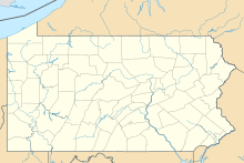
| Map | |||||||||||
| Location of airport in Pennsylvania / United States | |||||||||||
| Runways | |||||||||||
|
|||||||||||
| Statistics (2006) | |||||||||||
|
|||||||||||
|
Source: Federal Aviation Administration
|
|||||||||||
| Aircraft operations | 68,940 |
|---|---|
| Based aircraft | 137 |
Beaver County Airport or (IATA: BFP, ICAO: KBVI, FAA LID: BVI) is a county-owned public airport three miles northwest of Beaver Falls, in Beaver County, Pennsylvania.
Most U.S. airports use the same three-letter location identifier for the FAA and IATA, but Beaver County Airport is BVI to the FAA and BFP to the IATA (which assigned BVI to Birdsville Airport in Birdsville, Queensland, Australia).
The airport covers 228 acres (92 ha) and has one asphalt runway, 10/28, 4,501 x 100 ft (1,372 x 30 m). In the year ending December 30, 2006 the airport had 68,940 aircraft operations, average 188 per day: 99.9% general aviation and 0.1% military. 137 aircraft are based at this airport: 78% single-engine, 15% multi-engine, 4% jet and 2% helicopter.
On August 23, 1987, the B-17 Flying Fortress Nine-O-Nine crashed during an airshow at the airport. The plane was attempting to land but ran off the end of the runway and was badly damaged. It has been repaired and continues to fly at airshows across the United States.
The Beaver Valley Flying Club, Inc is a not-for-profit organization which has been in operation since 1967 on the Airport. The Club operates a G500 Cessna 172 and a 2002 Archer III.
...
Wikipedia


