Bears Ears National Monument
| Bears Ears National Monument | |
|---|---|
| Hoon’Naqvut, Shash Jaaʼ, Kwiyagatu Nukavachi, Ansh An Lashokdiwe | |
|
IUCN category V (protected landscape/seascape)
|
|

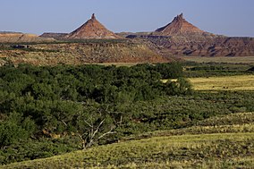
Indian Creek Canyon and the Sixshooter Peaks
|
|
| Nearest city | Blanding, Utah, US |
| Coordinates | 37°42′N 109°55′W / 37.70°N 109.92°WCoordinates: 37°42′N 109°55′W / 37.70°N 109.92°W |
| Area | 1,351,849 acres (547,074 ha) |
| Established | December 28, 2016 |
| Governing body | Bureau of Land Management/United States Forest Service |
| Website | Bears Ears National Monument |
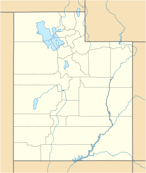
Bears Ears National Monument is a United States National Monument located in San Juan County in southeastern Utah. The monument protects 1,351,849 acres (547,074 ha) of public land surrounding the Bears Ears, a pair of mesas. The name of the region is the same in each of the native languages represented there; the names are listed in the presidential proclamation as "Hoon’Naqvut, Shash Jáa [sic], Kwiyagatu Nukavachi, Ansh An Lashokdiwe" meaning 'Bears Ears'. The area within the monument is largely undeveloped and contains a wide array of historic, cultural and natural resources. The monument is co-managed by the Bureau of Land Management and United States Forest Service (through the Manti-La Sal National Forest), along with a coalition of five local Native American tribes; the Navajo Nation, Hopi, Ute Mountain Ute, Ute Indian Tribe of the Uintah and Ouray Reservation, and the Pueblo of Zuni, all of which have ancestral ties to the region. The monument borders Canyonlands National Park and Glen Canyon National Recreation Area and surrounds Natural Bridges National Monument. The monument includes the Valley of the Gods, Indian Creek Canyon, the western part of the Manti-La Sal National Forest's Monticello unit, and the Dark Canyon Wilderness. On June 12, 2017 Secretary of the Interior Ryan Zinke "proposed significantly scaling back the borders" of Bears Ears in a "legally unprecedented move". Local farmers and ranchers want a "rollback of the protected areas"; others want to drill for oil.
...
Wikipedia


