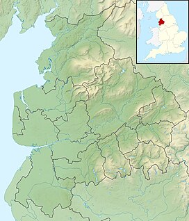
Beacon Fell, Lancashire
| Beacon Fell | |
|---|---|
| Highest point | |
| Elevation | 266 m (873 ft) |
| Coordinates | 53°52′47″N 2°39′36″W / 53.8796°N 2.6601°WCoordinates: 53°52′47″N 2°39′36″W / 53.8796°N 2.6601°W |
| Geography | |
| Location | Lancashire, England |
| OS grid | SD567428 |
Beacon Fell is a fell in the civil parish of Goosnargh in Lancashire, England. It has been a Country Park since 1970. It is situated on the edge of the Forest of Bowland Area of Outstanding Natural Beauty although it is separated from the other hills in the Forest.
Beacon Fell is an isolated hill 2 miles (3 km) south of the main range of hills in the Forest of Bowland. Although, at 266 metres (873 ft) above sea level, small compared with the neighbouring fells, its position offers commanding views over the flat plain of the Fylde and Morecambe Bay to the west, as well as the Ribble valley to the south.
From Beacon Fell there are extensive views
On a clear day the Welsh hills, the Lake District hills and the Isle of Man may be visible.
The high visibility of the fell made it an ideal location for a warning beacon. A beacon on the fell has been recorded as early as 1002. The fell formed part of a chain of beacons to warn of the approach of the Spanish Armada in 1588, and of French forces between 1795 and 1815. More recently, beacon chains have been lit in celebration of coronations and jubilees.
In 1909, Fulwood Urban District Council bought the fell, which until then had been farmland, as a water supply. Under the provisions of the Fulwood and Whittingham Water Act of 1882, water from the fell was collected in the existing Barnsfold Reservoirs, 1 mile (2 km) to the south-west, and from there piped to Fulwood and Whittingham Asylum via Horns Dam Reservoir in Goosnargh parish and a small covered reservoir in Haighton. Conifer woodland was planted on the fell to help manage drainage. From 1959, the fell was no longer required for water, and was left to fall into disrepair.
...
Wikipedia

