Baxter State Park
| Baxter State Park | |
|---|---|
|
IUCN category Ib (wilderness area)
|
|

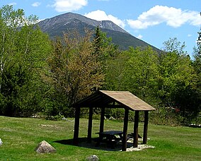
Katahdin rises above Katahdin Stream Campground in Baxter State Park.
|
|
| Location | Piscataquis County, Maine, United States |
| Nearest city | Millinocket |
| Coordinates | 46°2′N 68°56′W / 46.033°N 68.933°WCoordinates: 46°2′N 68°56′W / 46.033°N 68.933°W |
| Area | 209,501 acres (847.82 km2) |
| Established | March 3, 1931 |
| Visitors | 63,000 (in 2008) |
| Governing body | Baxter State Park Authority |
Baxter State Park is a large wilderness area permanently preserved as a state park, located in Piscataquis County in north-central Maine, United States. It is in the North Maine Woods region, and borders the Katahdin Woods and Waters National Monument.
The park was established by 28 donations of land, in trust, from park donor Percival P. Baxter between the years of 1931 and 1962, eventually creating a park of over 200,000 acres (809 km2) in size. Baxter Park is not part of the Maine State Park system. Sole governance is provided by the Baxter State Park Authority, consisting of the Maine Attorney General, the Maine Commissioner of Inland Fisheries and Wildlife and the Director of the Maine Forest Service. The park is independently funded through a combination of revenues from trusts, user fees, and the sale of forest products from the park's Scientific Forest Management Area. The park is home to the state's highest peak, Mount Katahdin. The number of visitors to the park declined from 75,000 in 2000 to 55,000 in 2005, but since 2005 visitor use has been slowly increasing.
Mount Katahdin consists of a cluster of mountains. The highest peak, Baxter Peak, is named after park donor and former Maine Governor Percival P. Baxter and rises up to 5,267 feet (1,605 m). The mountain is the northern terminus of the Appalachian Trail.
There are many bodies of water in the park. The three largest bodies of water are Grand Lake Matagamon, Webster Lake, and Nesowadnehunk Lake. There are also several smaller ponds, such as Hudson, Draper, Russell, Center and the South Branch ponds. Numerous streams and rivers connect these water bodies, most prominently Trout Brook (between Grand Lake Matagamon and Nesowadnehunk Lake) and Nesowadnehunk Stream (connecting Nesowadnehunk Lake and the small collection of ponds near Sentinel Mountain). Some of these have waterfalls; Nesowadnehunk Stream has Big and Little Niagara Falls, as well as Ledge Falls. Wassataquoik Stream has two waterfalls, Grand and Norway; another popular waterfall is Green Falls, tucked between Bald Mt. and South Pogy Mt. None of this water is potable, and the park advises that visitors bring or treat their water.
...
Wikipedia


