Battle of Lindley's Mill
| Battle of Lindley's Mill | |||||||
|---|---|---|---|---|---|---|---|
| Part of the American Revolutionary War | |||||||
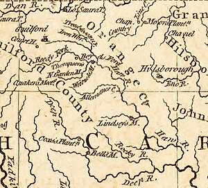
 A portion of Thomas Kitchin's 1781 map of North Carolina, depicting Hillsborough, the Haw River, and Lindley's Mill on Cane Creek (spelled here "Lindsey's M.") |
|||||||
|
|||||||
| Belligerents | |||||||
|
|
|
||||||
| Commanders and leaders | |||||||
|
|
|
||||||
| Strength | |||||||
| 300 | 600 | ||||||
| Casualties and losses | |||||||
| 24 killed 90 wounded 10 captured |
27 killed 90 wounded |
||||||
![]() David Fanning +
David Fanning +![]() Hector McNeill †
Hector McNeill †
The Battle of Lindley's Mill (also known as the Battle of Cane Creek) took place in Orange County, North Carolina (now in Alamance County), on September 13, 1781, during the American Revolutionary War. The battle took its name from a mill that sat at the site of the battle on Cane Creek, which sat along a road connecting what was then the temporary state capital, Hillsborough, with Wilmington, North Carolina.
...
Wikipedia
