Battle of Arlon
|
Arlon Aarlen (Dutch) Arel (German) |
|||
|---|---|---|---|
| Municipality | |||

Arlon centre with bell tower of St. Martin's Church
|
|||
|
|||
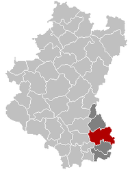
| Location in Belgium | |||
| Coordinates: 49°41′N 05°49′E / 49.683°N 5.817°ECoordinates: 49°41′N 05°49′E / 49.683°N 5.817°E | |||
| Country | Belgium | ||
| Community | French Community | ||
| Region | Wallonia | ||
| Province | Luxembourg | ||
| Arrondissement | Arlon | ||
| Government | |||
| • Mayor | Vincent Magnus (cdH) | ||
| • Governing party/ies | cdH, PS | ||
| Area | |||
| • Total | 118.64 km2 (45.81 sq mi) | ||
| Population (1 January 2016) | |||
| • Total | 29,274 | ||
| • Density | 250/km2 (640/sq mi) | ||
| Postal codes | 6700, 6704, 6706 | ||
| Area codes | 063 | ||
| Website | www.arlon.be (in French) | ||
| (Margraviate) County of Arlon | ||||||||||
| State of the Holy Roman Empire | ||||||||||
|
||||||||||
| Capital | Arel (Arlon) | |||||||||
| Government | Principality | |||||||||
| Historical era | Middle Ages | |||||||||
| • | Established | 950 | ||||||||
| • | Raised to margraviate | ca 1167 | ||||||||
| • | United with the County of Luxemburg | 1214 | ||||||||
| • | Annexed to the Duchy of Luxembourg | 1221 | ||||||||
|
||||||||||
Arlon (French pronunciation: [aʁlɔ̃]; Luxembourgish: Arel; Dutch: Aarlen, pronounced [ˈaːrlə(n)]; German: Arel; Walloon: Årlon) is a Walloon city and municipality of Belgium located in and capital of the province of Luxembourg. With a population of just over 28,000, it is the smallest provincial capital in Belgium. Arlon is also the capital of its cultural region : the Arelerland (Land of Arlon in Luxemburgish).
The municipality consists of the following sub-municipalities: Arlon proper, Autelbas-Barnich, Bonnert, Guirsch, Heinsch, and Toernich. Other population centers include:
Before the Roman conquests of Gaul, the territory of Arlon and a vast area to the southeast were settled by the Treveri, a tribe of mixed Celtic and Germanic origins. The local population adapted relatively easily to Roman culture. The number and quality of sculpted stones and monuments that have been unearthed in the area demonstrate that the vicus of Orolaunum quickly became a vibrant commercial and administrative centre of Roman civilization. The Germanic invasions of the 3rd century destroyed most of these early advances, despite the defensive walls that had been built on the Knipchen hill to protect the vicus.
...
Wikipedia


