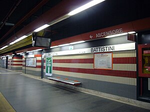
Battistini (Rome Metro)
 |
|||||||||||
| Coordinates | 41°54′23″N 12°24′53″E / 41.906461°N 12.414722°ECoordinates: 41°54′23″N 12°24′53″E / 41.906461°N 12.414722°E | ||||||||||
| Owned by | Atac di Roma | ||||||||||
| Tracks | 2 | ||||||||||
| Construction | |||||||||||
| Structure type | Underground | ||||||||||
| History | |||||||||||
| Opened | 2000 | ||||||||||
| Services | |||||||||||
|
|||||||||||
Battistini is an underground station on Line A of the Rome Metro, situated at the junction of via Mattia Battistini and via Ennio Bonifazi, in the 19th district. The station was inaugurated, together with the others from Valle Aurelia - Battistini on 1 January 2000 since when it has been the northernmost station on Line A.
This station has:
...
Wikipedia
