Bassin de la Villette
| Bassin de la Villette | |
|---|---|

The Bassin de la Villette
|
|
| Location | Paris |
| Coordinates | 48°53′10″N 2°22′30″E / 48.88611°N 2.37500°ECoordinates: 48°53′10″N 2°22′30″E / 48.88611°N 2.37500°E |
| Type | Basin |
| Part of | Parisian Canal Network |
| First flooded | December 2, 1808 |
| Max. length | 800 m (2,600 ft) |
| Max. width | 70 m (230 ft) |
| Settlements | Paris |
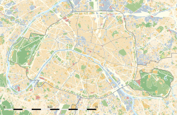
The Bassin de la Villette (La Villette Basin) is the largest artificial lake in Paris. It was filled with water on 2 December 1808. Located in the 19th arrondissement of the capital, it links the Canal de l'Ourcq to the Canal Saint-Martin, and it represents one of the elements of the Réseau des Canaux Parisiens (Parisian Canal Network), a public-works authority operated by the city. The other components of the network are the Canal de l'Ourcq, the Canal Saint-Denis, the Canal Saint-Martin, and the Bassin de l'Arsenal. Together, these canals and basins extend roughly 130 kilometres (81 mi).
Rectangular, eight hundred metres in length and seventy metres in width, it begins at the Rue de Crimée lifting bridge, the last bridge in Paris that can be raised and lowered hydraulically to permit the passage of ship and barge traffic beneath it, and it ends at the Place de la Bataille-de-Stalingrad near the Rotunda de la Villette. River cruise boats tie-up here and the shores of the basin are also the location of the MK2 Quai de Loire and MK2 Quai de Seine theatre complexes which are the most modern in France. A small electric passenger ferry, the Zéro de conduite, is available for transporting people from one side of the basin to the other.
The basin is bordered in the north by the Quai de la Seine and in the south by the Quai de la Loire, which are linked in the middle of the basin by a footbridge, the Passerelle de la Moselle.
The first Bassin de la Villette is 699 metres long and 70 metres wide. It has served several functions.
Its original function was to serve as a reserve of drinking water for Parisians. Its secondary function, in association with the second basin, was to provide water for navigation on the canals of Saint-Denis and Saint-Martin.
At the beginning of the 19th century the first basin was surrounded by gardens where Parisians came to spend pleasant interludes (walking in summer, skating in winter). But the industrial era of the 1850s saw the disappearance of this aspect of recreation. Goods depots were built on the banks.
...
Wikipedia

