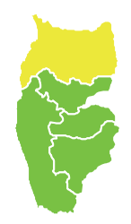
Baniyas District
|
Baniyas District منطقة بانياس |
|
|---|---|
| District | |
 Map of Baniyas District within Tartus Governorate |
|
| Coordinates (Baniyas): 35°10′56″N 35°56′25″E / 35.1822°N 35.9403°ECoordinates: 35°10′56″N 35°56′25″E / 35.1822°N 35.9403°E | |
| Country |
|
| Governorate | Tartus |
| Seat | Baniyas |
| Subdistricts | 7 nawāḥī |
| Area | |
| • Total | 581.30 km2 (224.44 sq mi) |
| Population (2004) | |
| • Total | 174,233 |
| • Density | 300/km2 (780/sq mi) |
| Geocode | SY1002 |
Baniyas District (Arabic: منطقة بانياس, translit. manṭiqat Bāniyās) is a district of the Tartus Governorate in northwestern Syria. Administrative centre is the city of Baniyas. At the 2004 census, the district had a population of 174,233.The estimated population of the Alawites of Baniyas is approximately 105 thousand, while the number of Sunni population is estimated at 45 thousand, in addition to 20 thousand Christians, according to the Syrian network for human rights.
The district of Baniyas is divided into seven sub-districts or nawāḥī (population as of 2004):
...
Wikipedia
