Bandundu Province
|
Bandundu Province Province du Bandundu |
|
|---|---|
| Province | |

|
|
 |
|
| Country |
|
| Capital | Bandundu |
| Largest city | Kikwit |
| Government | |
| • Governor | Jean Kamisendu Kutuka |
| Area | |
| • Total | 295,658 km2 (114,154 sq mi) |
| Population (2010 est.) | |
| • Total | 8,062,463 |
| • Density | 27/km2 (71/sq mi) |
| Official language | French |
| National language | Kikongo, Lingala |
Bandundu is one of eleven former provinces of the Democratic Republic of the Congo. It bordered the provinces of Kinshasa and Bas-Congo to the west, Équateur to the north, and Kasai-Occidental to the east. The provincial capital is also called Bandundu (formerly Banningstad/Banningville).
Bandundu was formed in 1966 by merging the three post-colonial political regions: Kwilu, Kwango, and Mai-Ndombe. Under the 2006 constitution, Bandundu was to be broken up again into the aforementioned political regions. Kwilu province was to be formed by combining Kwilu district and the city of Kikwit, Kwango province was to be formed from Kwango district, and Mai-Ndombe province was to be formed by combining Plateaux District, Mai-Ndombe District and the city of Bandundu. Following much delay, by 2016 the change had taken effect.
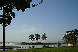
The landscape of Bandundu province consisted primarily of plateaus covered in savanna, cut by rivers and streams that are often bordered by thick forest. The province was bisected by the Kasai River, which flows into the Congo River on the province's western boundary. Other major rivers are the Kwango, Kwenge, Kwilu and Lukenie.Lake Mai-Ndombe is the largest lake, with this lake and the surrounding swamp forest forming the southern portion of the Tumba-Ngiri-Maindombe Ramsar wetlands.
...
Wikipedia
