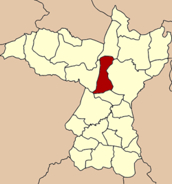
Ban Fang District
|
Ban Fang บ้านฝาง |
|
|---|---|
| Amphoe | |
 Amphoe location in Khon Kaen Province |
|
| Coordinates: 16°27′12″N 102°38′18″E / 16.45333°N 102.63833°ECoordinates: 16°27′12″N 102°38′18″E / 16.45333°N 102.63833°E | |
| Country |
|
| Province | Khon Kaen |
| Seat | Ban Fang |
| Area | |
| • Total | 334.0 km2 (129.0 sq mi) |
| Population (2005) | |
| • Total | 52,999 |
| • Density | 158.7/km2 (411/sq mi) |
| Time zone | THA (UTC+7) |
| Postal code | 40270 |
| Geocode | 4002 |
Ban Fang (Thai: บ้านฝาง, pronounced [bâːn fǎːŋ]) is a district (Amphoe) of Khon Kaen Province, northeastern Thailand.
The minor district (King Amphoe) Ban Fang was established on May 1, 1975 by splitting the four tambon Nong Bua, Pa Wai Nang, Ban Lao and Non Khong from Mueang Khon Kaen district. On March 25, 1979 it was upgraded to a full district.
Neighboring districts are (from the north clockwise) Ubolratana, Mueang Khon Kaen, Phra Yuen, Mancha Khiri and Nong Ruea.
The district is subdivided into 7 subdistricts (tambon), which are further subdivided into 74 villages (muban). The township (thesaban tambon) Ban Fang covers parts of the tambon Ban Fang. There are further 7 Tambon administrative organizations (TAO).
...
Wikipedia
