
Baker River (Washington)
| Baker River | |
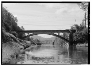 Baker River at Concrete
|
|
| Country | United States |
|---|---|
| State | Washington |
| County | Skagit, Whatcom |
| Source | Cascade Range |
| - location | Whatcom Peak, Whatcom County |
| - elevation | 5,800 ft (1,768 m) |
| - coordinates | 48°51′1″N 121°22′52″W / 48.85028°N 121.38111°W |
| Mouth | Skagit River |
| - location | Concrete, Skagit County |
| - elevation | 820 ft (250 m) |
| - coordinates | 48°45′54″N 121°32′34″W / 48.76500°N 121.54278°WCoordinates: 48°45′54″N 121°32′34″W / 48.76500°N 121.54278°W |
| Length | 30 mi (48 km) |
| Basin | 297 sq mi (769 km2) |
| Discharge | for river mile 0.7 near Concrete, WA |
| - average | 2,649 cu ft/s (75.0 m3/s) |
| - max | 36,600 cu ft/s (1,036.4 m3/s) |
| - min | 30 cu ft/s (0.8 m3/s) |
 Map of the Baker River watershed
|
|
 Location of the mouth of Baker River in Washington
|
|
The Baker River is an approximately 30-mile (48 km), southward-flowing tributary of the Skagit River in northwestern Washington in the United States. It drains an area of the high North Cascades in the watershed of Puget Sound north of Seattle, and east of Mount Baker. With a watershed of approximately 270 square miles (700 km2) in a broad and deep valley partially inside North Cascades National Park, it is the last major tributary of the Skagit before the larger river reaches its mouth on Skagit Bay. The river flows through Concrete, Washington near its mouth and has two hydroelectric dams owned by Puget Sound Energy.
The Baker River rises in the Cascade Range near Whatcom Peak, in the northern section of North Cascades National Park. It flows south, starting in the Baker River Valley north-east of Mount Shuksan. The river flows generally southwest through a steep glacial valley, receiving several short glacial-fed tributaries from surrounding mountains. Many of these tributaries harbor tall, but never officially measured waterfalls. Most of the southern half of the river is impounded in artificial lakes, both part of the Baker River Hydroelectric Project. The first reservoir is 9-mile (14 km)-long Baker Lake, impounded by Upper Baker Dam. (The lake was formerly a natural lake, until its level was raised by the 312-foot (95 m)-high dam.) Lake Shannon, impounded by Lower Baker Dam, begins immediately below Baker Lake and stretches about 7.5 miles (12.1 km) downstream. Below Lower Baker Dam the Baker River flows unimpeded (except for a small weir at a fish passage station) for about a mile before emptying into the Skagit River.
...
Wikipedia