Bình Định
|
Bình Định Province Tỉnh Bình Định |
|
|---|---|
| Province | |

Thi Nai Lagoon and Phuong Mai Peninsula
|
|
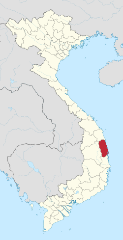
 Location of Bình Định Province within Vietnam |
|
| Coordinates: 14°10′N 109°0′E / 14.167°N 109.000°ECoordinates: 14°10′N 109°0′E / 14.167°N 109.000°E | |
| Country |
|
| Region | South Central Coast |
| Capital | Qui Nhơn |
| Government | |
| • People's Council Chair | Nguyễn Xuân Dương |
| • People's Committee Chair | Vũ Hoàng Hà |
| Area | |
| • Total | 6,025.1 km2 (2,326.3 sq mi) |
| Population (2004) | |
| • Total | 1,545,300 |
| • Density | 260/km2 (660/sq mi) |
| Demographics | |
| • Ethnicities | Vietnamese, Chăm, Ba Na |
| Time zone | ICT (UTC+7) |
| Area codes | 56 (until 16 July 2017) 256 (from 17 June 2017) |
| ISO 3166 code | VN-31 |
| Website | www |
Bình Định (![]() listen) is a province of Vietnam. It is located in Vietnam's South Central Coast region.
listen) is a province of Vietnam. It is located in Vietnam's South Central Coast region.
Bình Định was probably one of the places where the Cham first arrived in what is now Vietnam. Its favourable geography led to the rise of the Cham Port of Thị Nại where Quy Nhon is now located. The city-state of Vijaya was located around this port and the main city, which was further inland. Its centre was in the southern lowland of Bình Định. However, its architecture implies that it did not become important until the eleventh or twelfth century.
Vijaya's architecture also distinguishes it from other Champa centers, since it used a combination of stone and brick elements, while most other Cham structures only used bricks. This suggests some influence from Cambodian Angkor. It also points to the relative abundance of labour in Vijaya compared to other Champa centers of powers, because processing stones for construction was more labour-intensive than the production of bricks.
Vijaya was involved in various wars with neighbouring countries. Major wars were fought with Angkor (now Cambodia) in the 12th and 13th centuries. Around this time Vijaya seems to have been associated with and at times even dominated by the Khmer King Jayavarman VII. Major wars with Vietnam were fought in 1069 and again in the 15th century, which eventually led to the defeat of Vijaya and the demise of Champa in 1471.
The majority of Bình Định Province is covered by mountains or hills. Elevations range from 0 at the coast to around 1200 meters above sea level in An Lão District in the north-west of the province. While most of the mountains as well as the highest peaks are in the west, there are mountains throughout the province, even near the coast. Most districts of Bình Định have a topography that is a mix of mountains or hills and lowlands. The districts of An Lão in the north-west, Vĩnh Thạnh in the west, and Vân Canh in the south-west are mostly mountainous. All other districts have some lowlands.
...
Wikipedia
