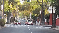
Azcapotzalco
| Azcapotzalco | |
|---|---|
| Municipio | |
 |
|
 Azcapotzalco within the Federal District |
|
| Coordinates: 19°28′58″N 99°11′00″W / 19.48278°N 99.18333°WCoordinates: 19°28′58″N 99°11′00″W / 19.48278°N 99.18333°W | |
| Country | Mexico |
| Federal entity | Mexico City |
| Established | 1928 |
| Named for | Ancient Tepanec city |
| Seat | Av. Castilla Oriente s/n esq. 22 de Febrero |
| Government | |
| • Jefe delegacional | Sergio Palacios Trejo (PRD) |
| Area | |
| • Total | 33.6 km2 (13.0 sq mi) |
| Population 2010 | |
| • Total | 414,711 |
| • Density | 12,000/km2 (32,000/sq mi) |
| Time zone | Central Standard Time (UTC-6) |
| • Summer (DST) | Central Daylight Time (UTC-5) |
| Postal codes | 02000-02990 |
| Area code(s) | 55 |
| Website | www.azcapotzalco.gob.mx |
| Azcapotzalco | ||||||||||||||||||||||||||||||||||||||||||||||||||||||||||||
|---|---|---|---|---|---|---|---|---|---|---|---|---|---|---|---|---|---|---|---|---|---|---|---|---|---|---|---|---|---|---|---|---|---|---|---|---|---|---|---|---|---|---|---|---|---|---|---|---|---|---|---|---|---|---|---|---|---|---|---|---|
| Climate chart () | ||||||||||||||||||||||||||||||||||||||||||||||||||||||||||||
|
||||||||||||||||||||||||||||||||||||||||||||||||||||||||||||
|
||||||||||||||||||||||||||||||||||||||||||||||||||||||||||||
| J | F | M | A | M | J | J | A | S | O | N | D |
|
9
23
5
|
8
25
6
|
11
28
9
|
31
28
11
|
61
28
12
|
148
26
13
|
166
25
12
|
160
25
12
|
114
24
12
|
63
24
11
|
7
24
8
|
7
23
6
|
| Average max. and min. temperatures in °C | |||||||||||
| Precipitation totals in mm | |||||||||||
| Source: http://smn.cna.gob.mx/ | |||||||||||
| Imperial conversion | |||||||||||
|---|---|---|---|---|---|---|---|---|---|---|---|
| J | F | M | A | M | J | J | A | S | O | N | D |
|
0.4
73
41
|
0.3
77
43
|
0.4
82
48
|
1.2
82
52
|
2.4
82
54
|
5.8
79
55
|
6.5
77
54
|
6.3
77
54
|
4.5
75
54
|
2.5
75
52
|
0.3
75
46
|
0.3
73
43
|
| Wikipedia
...
| |||||||||||
