Avenue A (Manhattan)

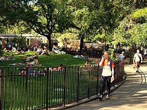
Tompkins Square Park lines Avenue A between East Seventh Street and East 10th Street.
|
|
| Owner | City of New York |
|---|---|
| Maintained by | NYCDOT |
| Length | 1.1 mi (1.8 km) |
| Location | Manhattan, New York City |
| South end | Houston |
| North end | 14th Street |
| East | Avenue B |
| West | First Avenue |
| Construction | |
| Commissioned | March 1811 |
Avenue A is a north-south avenue located in Manhattan, New York City, east of First Avenue and west of Avenue B. It runs from Houston Street to 14th Street, where it continues into a loop road in Stuyvesant Town, connecting to Avenue B. Below Houston Street, Avenue A continues as Essex Street.
It is considered to be the western border of Alphabet City in the East Village. It is also the western border of Tompkins Square Park.
Under the Commissioners' Plan of 1811 that established the Manhattan street grid, the avenues would begin with First Avenue on the east side and run through Twelfth Avenue in the west. East of First Avenue the plan provided four additional lettered avenues running from Avenue A eastward to Avenue D wherever they could be fitted.
While First Avenue was the easternmost avenue in most of Manhattan, several discontinuous sections were designated as Avenue A north of present-day Alphabet City.
A short section of Avenue A was cut off from the existing section in 1947 with the construction of Stuyvesant Town and Peter Cooper Village and is now known as Asser Levy Place, on which is located the Asser Levy Recreation Center and Park, which stretches from East 23rd to 25th Streets in Kips Bay. The Recreation Center includes the Asser Levy Public Baths, built in 1904-06.
...
Wikipedia
