Assateague Island National Seashore
| Assateague Island National Seashore | |
|---|---|
|
IUCN category V (protected landscape/seascape)
|
|

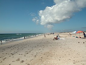
View of a beach on Assateague Island
|
|
| Location | Worcester County, Maryland & Accomack County, Virginia, USA |
| Nearest city | Ocean City, MD & Chincoteague, VA |
| Coordinates | 38°05′00″N 75°12′30″W / 38.08333°N 75.20833°WCoordinates: 38°05′00″N 75°12′30″W / 38.08333°N 75.20833°W |
| Area | 41,320 acres (167.2 km2) |
| Authorized | January 1, 1965 |
| Visitors | 2,105,419 (in 2011) |
| Governing body | National Park Service |
| Website | Assateague Island National Seashore |
Assateague Island National Seashore is a unit of the National Park Service occupying about half of Assateague Island, located off Maryland's eastern shore on the Atlantic Ocean. The park covers an area of 41,320 acres (16,720 ha). The portion of the island designated as national seashore extends South of the Ocean City inlet to the Maryland/Virginia state border. In addition, a one-mile portion of the VA district including the recreational beach and interpretive facilities is managed by the National Park Service. Over 2.1 million people visit the park each year. The park was created in 1965 after a strong nor'easter (the Ash Wednesday Storm of 1962) destroyed the planned, but never built, resort community of Ocean Beach, Maryland. The national seashore is famous for its white sand beaches and wild ponies.
The park is located on a barrier island shaped by the stormy seas and gentle winds along the coast of the Delmarva Peninsula. The island is approximately 37 miles (60 km) long, yet never more than a mile wide. The park is divided into the Maryland District in the north and the Virginia District in the south. It is not possible to drive down the island from one district to the other. All automobile traffic must enter the mainland before traveling to the other end of the island.
The Maryland District of Assateague Island National Seashore runs from the Ocean City Inlet in the north to the Virginia state line. This district contains a visitor center, campground, three nature trails, a life guarded beach, and the park's headquarters. The smaller Assateague State Park sits within the borders of this district. The only access to the Maryland district (and the state park) is via the Verrazano Bridge on Maryland Route 611.
The smaller Virginia District of Assateague Island National Seashore on the southern extremity island contains a visitor center and lifeguarded beach. While it is staffed by National Park Rangers, the land is within the jurisdiction of the Chincoteague National Wildlife Refuge and owned by the US Fish and Wildlife Service. However, about a one-mile portion including the recreational beach is managed by the National Park Service based on various agreements and Memorandum of Understandings between the US Fish and Wildlife Service and the National Park Service. This should not be confused with Chincoteague Island, which is a different island with a residential community on it. One must drive through Chincoteague Island in order to reach the Virginia District.
...
Wikipedia


