Arlington Heights, Massachusetts
| Arlington, Massachusetts | ||
|---|---|---|
| Town | ||

Ice Harvesting on Spy Pond, from an 1854 Print.
|
||
|
||
| Motto: Libertatis Propugnatio Hereditas Avita (Latin) "The Defense of Liberty is Our Ancestral Heritage" |
||
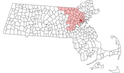
 Location in Massachusetts |
||
| Coordinates: 42°24′55″N 71°09′25″W / 42.41528°N 71.15694°WCoordinates: 42°24′55″N 71°09′25″W / 42.41528°N 71.15694°W | ||
| Country | United States | |
| State | Massachusetts | |
| County | Middlesex | |
| Settled | 1635 | |
| Incorporated | 1807 | |
| Renamed | 1867 | |
| Government | ||
| • Type | Representative town meeting | |
| • Town Manager | Adam Chapdelaine | |
| • Board of Selectmen |
Kevin Greeley Daniel Dunn Diane Mahon Joseph Curro Jr. Steven Byrne |
|
| Area | ||
| • Total | 5.5 sq mi (14.3 km2) | |
| • Land | 5.2 sq mi (13.4 km2) | |
| • Water | 0.3 sq mi (0.9 km2) | |
| Elevation | 46 ft (14 m) | |
| Population (2010) | ||
| • Total | 42,844 | |
| • Density | 8,239.2/sq mi (3,197.3/km2) | |
| Time zone | Eastern (UTC-5) | |
| • Summer (DST) | Eastern (UTC-4) | |
| ZIP code | 02474, 02475, 02476 | |
| Area code(s) | 339 / 781 | |
| FIPS code | 25-01605 | |
| GNIS feature ID | 0619393 | |
| Website | www.arlingtonma.gov | |
Arlington is a town in Middlesex County, Massachusetts, United States, six miles (10 km) northwest of Boston. The population was 42,844 at the 2010 census.
The Town of Arlington was settled by European colonists in 1635 as a village within the boundaries of Cambridge, Massachusetts under the name Menotomy, an Algonquian word meaning "swift running water". A larger area, including land that was later to become the town of Belmont, and outwards to the shore of the Mystic River, which had previously been part of Charlestown, was incorporated on February 27, 1807 as West Cambridge. In 1867, the name "Arlington" was chosen in honor of those buried in Arlington National Cemetery; the name change took effect that April 30.
The Massachusett tribe, part of the Algonquian group of Native Americans, lived around the Mystic Lakes, the Mystic River and Alewife Brook. By the time Europeans arrived, the local Indians had been devastated by disease; also, the tribal chief, Nanepashemet, had been killed by a rival tribe in about 1619. Nanepashemet's widow, known to history only as "Squaw Sachem", sold the land of her tribe to the colonists for ten pounds, with provisions that she and her tribe could remain on her homestead land around the Mystic Lakes and continue hunting and farming. She also was to be given a new winter coat of wool each year for the rest of her life. She is thought to have lived until about 1650.
...
Wikipedia

