Ardmore Municipal Airport
|
Ardmore Municipal Airport Ardmore Industrial Airpark |
|||||||||||||||
|---|---|---|---|---|---|---|---|---|---|---|---|---|---|---|---|

1995 orthophoto from USGS
|
|||||||||||||||
| Summary | |||||||||||||||
| Airport type | Public | ||||||||||||||
| Owner | City of Ardmore | ||||||||||||||
| Serves | Ardmore, Oklahoma | ||||||||||||||
| Elevation AMSL | 777 ft / 237 m | ||||||||||||||
| Coordinates | 34°18′15″N 097°01′14″W / 34.30417°N 97.02056°WCoordinates: 34°18′15″N 097°01′14″W / 34.30417°N 97.02056°W | ||||||||||||||
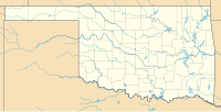
| Map | |||||||||||||||
| Location in Oklahoma | |||||||||||||||
| Runways | |||||||||||||||
|
|||||||||||||||
| Statistics (2009) | |||||||||||||||
|
|||||||||||||||
|
Source: Federal Aviation Administration
|
|||||||||||||||
| Aircraft operations | 45,729 |
|---|---|
| Based aircraft | 15 |
Ardmore Municipal Airport (IATA: ADM, ICAO: KADM, FAA LID: ADM) is in Carter County, Oklahoma, 12 miles (19 km) northeast of the city of Ardmore, which owns it. It is near Gene Autry, Oklahoma. The National Plan of Integrated Airport Systems for 2011–2015 called it a general aviation airport.
The airport is on the site of Ardmore Army Air Field (1942 to 1946), later Ardmore Air Force Base (1953 to 1959).
Central Airlines served Ardmore from about 1951 until 1963.
On April 22, 1966 American Flyers Flight 280, flying a Lockheed Electra L-188 on approach to Ardmore crashed into a hill. 83 of the 98 aboard were killed. This was a flight under charter to the Military Air Command, enrollee from Montery, California to Columbus, Georgia, with a scheduled refueling stop at Ardmore. An autopsy showed that the pilot had suffered a massive heart attack during the attempted landing. He was not wearing his harness and slumped forward into the controls, which prevented the co-pilot from taking control. Subsequent investigation showed that the pilot was under treatment for arteriosclerosis and diabetes, but that he had falsified information on his application for a First Class Medical Certificate, which would have been denied except for the falsification.
Ardmore Municipal Airport covers 2,503 acres (1,013 ha) at an elevation of 777 feet (237 m). It has two runways: 13/31 is 9,001 by 150 feet (2,744 x 46 m) concrete and 17/35 is 5,350 by 100 feet (1,631 x 30 m) asphalt.
...
Wikipedia

